
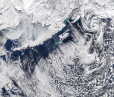
Albedo has been approved to sell 10-cm commercial satellite imagery, the startup announced yesterday. The National Oceanic and Atmospheric Administration (NOAA) has granted a first-of-its-kind license to Albedo, allowing it to sell satellite imagery at a resolution of 10 cm/pixel. That’s more granular than anything commercially offered today.
Changing times…A few decades ago, the US greenlighted the sale of commercial imagery from space—with resolution caps and plenty of other caveats.
As remote-sensing constellations with new sensor modalities have come online, “there’s been a lot of push from the industry for the government to loosen restrictions to increase US competitiveness,” Albedo cofounder and CEO Topher Haddad told Payload.
Driven by emerging US commercial capabilities—and the increasing caliber of foreign sensing constellations—Uncle Sam put a new, three-tiered licensing process in place. The rules, promulgated in 2020, were cheered by industry for better balancing national security and economic competitiveness equities.
- The permitting process was fairly straightforward, Haddad said. “I’d definitely applaud NOAA…and the Department of Commerce for how they implemented these new regulations.”
As for the caveats? Imagery of sensitive government sites (ahem, Area 51) must be preapproved for self-explanatory reasons. There’s revisit rate limits and encrypted data transfer requirements, along with other restrictions that Haddad declined to discuss.
- Albedo’s license is categorized “Tier 3,” which covers completely new sensing capabilities.
- Within this bucket, the sale of commercial imagery can be temporarily limited, if requested by the Pentagon or US intelligence community.
Albedo still needs to build and deploy its remote-sensing satellites before it can use its license. To get its promised high-res optical (10cm) and thermal (4m) imagery, Albedo will launch its birds into very low-Earth orbit (VLEO).
“We cut the distance in half from a normal LEO altitude,” Haddad said. How is that done? A proprietary software/hardware stack, bespoke for VLEO. Albedo is developing control algorithms and a gestalt system design packed in an efficient, compact form factor, Haddad said.
Looking forward: The pre-Series A, Y Combinator W21 alum “has a few more years of heads-down” building, Haddad said. The NOAA license helps derisk the business plan from a regulatory perspective—“now, it’s more just execution.”
Exclusive: Tilebox Launches AI-Focused Update
Tilebox announced an update today aiming to make AI agents more effective geospatial-data analysts.
Symphony Space Unveils Adagio-XL ODC Sat
With Adagio-XL, Symphony Space is getting into the orbital data center game.
Orbital Raises $5M Pre-Seed to Build ODC Constellation
Orbital’s ODC concept instead relies on a network of relatively smaller satellites, which can together handle large AI inference workloads, and remain in constant contact with the ground.
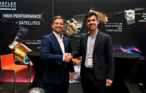
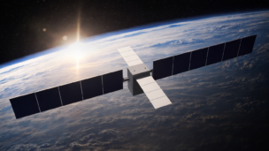
Reflex Aerospace Taps Arkadia Space for 2027 Mission
Reflex Aerospace selected Spanish startup Arkadia Space to provide a propulsion system for its satellite mission, launching in 2027.
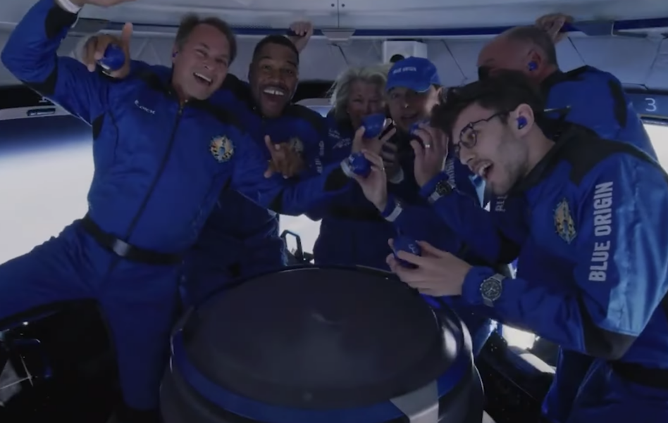
Things are picking up in space tourism. Over the weekend, a record-breaking 19 people were in space at once during Blue Origin’s six-passenger tourist flight. And it’s only going up from there.
Over the last week, two flights carrying eight total private space tourists launched: Blue Origin’s NS-19 mission carrying Michael Strahan et al to suborbital altitudes on Saturday, and a shuttle bringing Japanese billionaire Yusaku Maezawa and his film assistant Yozo Hirano to the ISS.
Sky-high costs: Right now, these flights are pricey. Neither company has publicly stated what a ticket on these past trips ran its customers, but Maezawa’s tickets likely fell in the $50-60M range and a ride on Blue Origin’s New Shepard is estimated between $200,000-$500,000. But there’s demand, and as commercial space companies begin to plan larger flights, those prices could drop.
Ramping up: The space industry is gearing up for more frequent tourist flights. Virgin Galactic has announced its intention to eventually launch 400 ticketed flights per year, and SpaceX’s Starship could carry up to 100 tourists at a time.
Keep reading