

Geospatial intelligence startup Wherobots launched a new product today—called RasterFlow—aimed at making EO data more accessible.
The volume of EO images has grown exponentially the past decade, but cleaning up, deciphering, and extracting value from these datasets remains manual, expensive, and time-consuming, according to Wherobots officials.
“There isn’t actually a real platform that exists out there that can automatically detect, classify, and understand what’s happening within this imagery,” Wherobots CEO Mo Sarwat told Payload. “AI doesn’t understand the real world…So RasterFlow is going to bring that understanding of the physical world to AI agents.”
How it works: EO data is messy. Diverse image sets are often taken using satellites peering at different angles, and riddled with obstructions from cloud cover—all of which requires manual data processing to make the images useful. Even custom AI models struggle without human interaction.
Wherobots aims to reduce the labor-intensive cleanup by injecting AI earlier in the process:
- RasterFlow uses automation to coalesce datasets from multiple EO providers. It “mosaics” imagery (meaning, it layers photos on top of one another to avoid cloud-cover disruptions), and preprocesses data to be useful to AI agents.
- RasterFlow then runs AI and/or ML models on top of this data to quickly glean insights, such as detecting changes in the landscape, or performing other analysis to spot unique trends.
While this description is a little…nondescript, that’s kind of the point. As opposed to AI solutions built by satellite operators or enterprise users, RasterFlow is designed to service the whole market by being agnostic to the data and models being fed in.
“RasterFlow is basically looking at the whole experience of the community building all these DIY solutions, and making it a much more abstracted system that enables them to plug their own models, plug their own data, and [not] have to worry about compute infrastructure,” Sarwat said.
AI for all: Wherobots has already seen interest from many EO entities, officials said. RasterFlow was developed with input from Taylor Geospatial Engine, SatSure, and Spyrosoft, all of whom signed on as initial customers.
The real value of the product, however, is its ability to make EO data more accessible to a wider range of customers and use cases.
“We provide a very low cost solution for them that works almost right off the bat,” Sarwat said. “Instead of just very focused satellite imagery experts working on these very narrow use cases…we are hoping there will be a plethora of new applications that we didn’t even think of.”
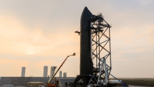
What to Expect from Starship V3
SpaceX CEO Elon Musk announced the first launch of Starship V3 was “about 4 weeks” away.

Seraphim Space Investment Trust Posts Record Results
Seraphim Space Investment Trust ($SSIT) announced its financial results for H2 2025, revealing a successful portfolio of global space businesses that have seen valuations buoyed by geopolitical trends.
ICEYE Launches New Deforestation Monitoring Tool
ICEYE just one-upped the Lorax. Instead of speaking for the trees, the SAR satellite manufacturer is letting the trees speak for themselves.

Exclusive: Starpath Unveils New Ultra-Thin Space Solar Panels
The panels are just 73g per square meter, and are priced around $15 per watt.

Overview Energy is emerging from stealth today, announcing a milestone towards eventually beaming solar power to Earth.
The Virginia-based startup, which was founded in 2022, has raised $20M so far. The money is going towards building a fleet of satellites in geosynchronous orbit that are designed to collect solar power in space, and use low-intensity, near-infrared light to deliver that power to Earth’s existing solar energy grid.
Going off-Earth to collect sunlight allows solar power to be a more reliable energy source for terrestrial industries—including at night, Overview officials say.
Keep reading