
Satellogic ($SATL) notched a big win in its quest to capture more American business opportunities with a new remote sensing license granted by NOAA.
“US defense, intelligence, and civilian agencies have recognized a significant and growing need to collaborate with commercial partners like Satellogic that can provide rapid, accurate, and trusted geospatial data for a range of global applications,” Matt Tirman, president of Satellogic, said Tuesday in a release.
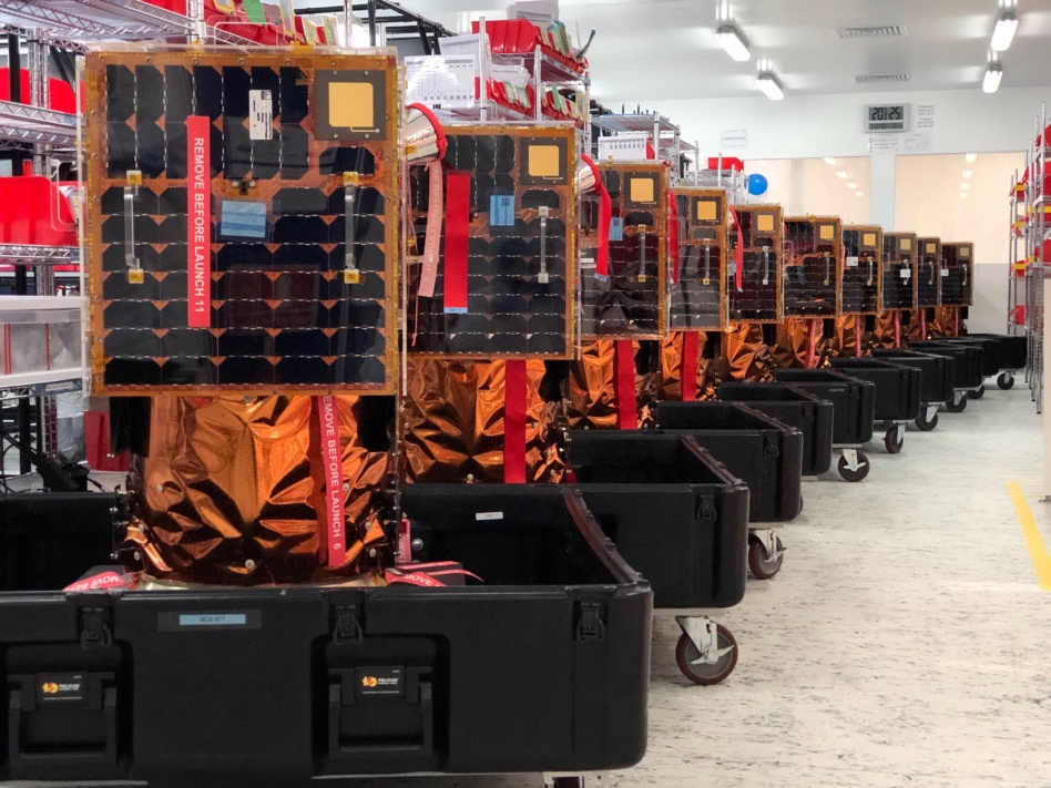
Moving house: Satellogic has been building and operating EO satellites equipped with optical and multispectral sensors since it was founded in Buenos Aires, Argentina, in 2010. The company went public via SPAC in January 2022 in a merger that provided $262M in gross proceeds.
During the company’s H1 2023 financial results call, executives announced that Satellogic would realign its business in the US to capture more government and commercial contracts. That shift included two key changes:
- Redomiciling the company from the British Virgin Islands to Delaware by the first half of 2024
- Securing a remote sensing license from NOAA for its Aleph-1 constellation
The first goal is still in progress, but the second can be checked off the list.
What’s next? Earning a NOAA remote sensing license means that Satellogic is now subject to the agency’s oversight. It also means that the company is able to open up ground stations in the US to downlink from its Aleph-1 constellation, and that US personnel can now take the lead on satellite operations.
The license allows Satellogic to pursue more opportunities for contracts and partnerships with US military and civil agencies, a key area of growth for the company’s remote sensing data.

Exclusive: Tilebox Launches AI-Focused Update
Tilebox announced an update today aiming to make AI agents more effective geospatial-data analysts.

Recapping Planet’s Q1 With CFO and President Ashley Johnson
“That’s one of the ways that I think we’re differentiated from companies that are going to have much more binary outcomes,” she said. “If you’re selling hardware, you recognize revenue when you’ve delivered that hardware. If it fails, that’s the end of the story.”
Bellatrix Aerospace Tapped to Build Korean VLEO Demo Sat
Bellatrix Aerospace is teaming up with Korean optical payload manufacturer TelePIX on a new VLEO demo satellite, launching NET 2028.

Satellogic Lands $18M+ Defense-Monitoring Contract
The contract marks the company’s first large agreement since it made that strategic shift to persistent-monitoring capabilities.

The road to Starship’s next test flight runs through Washington.
During Saturday’s flight, Starship made big strides, reaching space before blowing up at an altitude of 148 km, way above the 39 km attained during its first flight in April. But it still fell short of a few goals, including reaching suborbital flight before splashing down in the ocean.
Elon Musk said he expects hardware to be ready to try again in three to four weeks. But when SpaceX can fly is also up to the FAA, which lawmakers dinged for its sluggish process of clearing the launch giant for its second flight.
Keep reading