
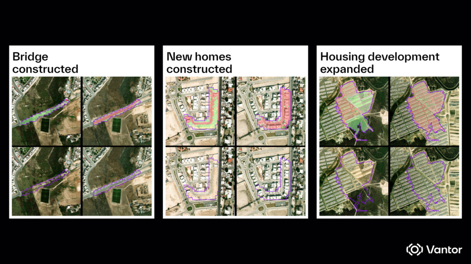
Vantor won a $5.3M NGA contract to help the government combine data sources for accurately tracking changes to Earth’s landscape.
More info: The contract, awarded under NGA’s Luno B program, will see Vantor provide the intelligence community with data about shifts to things like roads, vegetation, and buildings, as well as broader impacts caused by manmade or natural disasters. The company will use AI to rapidly detect any shifts across the huge data set.
Melting pot: To best meet the needs of the NGA, Vantor will combine its own 30-cm high res EO imagery with third-party sensors to give a complete picture of the globe. Different data sources all offer different strengths, including:
- High-res imagery detects small changes in roads or buildings;
- SAR provides a picture of the ground at night, or in clouds.
Combining multiple data sources offers a comprehensive picture for the government to respond to things like regional conflicts or humanitarian disasters—but the approach doesn’t come without challenges, according to Susanne Hake, the executive vice president and general manager of US government at Vantor.
“What we’re seeing is that the missions that our customers are asking us to perform really do require pulling together multiple types of data,” Hake said. “They want a complete picture.”
Hake said Vantor will use its precision alignment tech to make sure the data merges together accurately—a key factor for tracking change.
“Fusing data from multiple sensors is challenging because each one captures the world differently,” Hake said. “For example, there are different resolutions, viewing angles, and levels of spatial accuracy. If those differences aren’t addressed first, change detection models won’t work, because they rely on precise, pixel-level alignment to identify what changed on the ground.”
Watchful eye: Going through the huge mountain of data to detect shifts swiftly requires the use of AI, with a human in the loop for quality control and setting collection parameters.
“Using AI is obviously a time savings, but it’s also to help scale,” Hake said. “To do continuous change detection across the entire world’s terrain at scale, that’s when you really need to be able to use AI.”

Exclusive: Vast Debuts Flight Suit For Haven-1, Private Astronaut Missions
Cargo pants are so back.
Atomic-6 Launches Orbital Data Center Marketplace
GA-based composite manufacturer Atomic-6 is fueling that acceleration with the launch of a new marketplace today—called ODC.Space—to make securing orbital compute as simple as “add to cart.”
Sophia Space and Kepler Sign Agreement to Demo ODC Tech
The agreement, announced today, is Sophia’s first opportunity to validate its orbital-data-center software in space.
Hawkeye 360 Files For IPO
The space-based RF data and analytics firm is the latest in a string of defense-focused space companies seeking to go public, opening access to more capital as the industry grows.
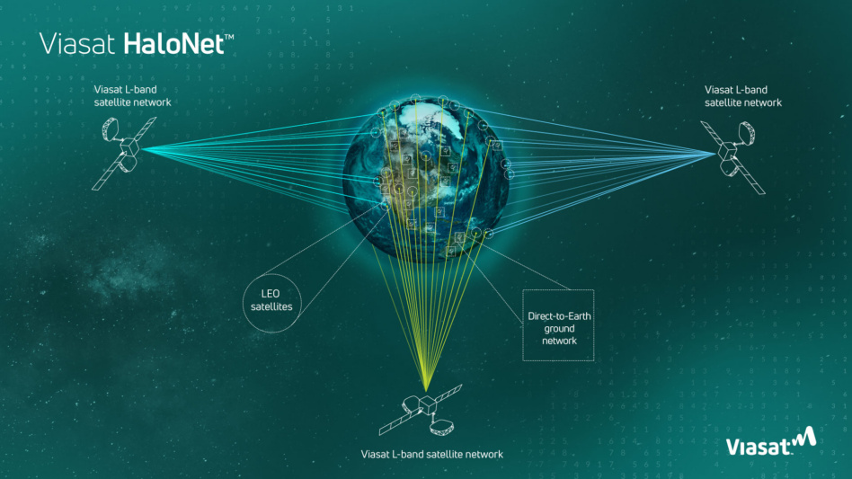
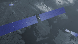
Part 3 in a series on orbital communications
In today’s rapidly proliferating orbital environment, spacecraft are only as capable as their ability to stay connected. Traditional communications architectures—built around scheduled ground passes and line-of-sight links—can’t keep pace with the speed and complexity of modern missions.Viasat’s HaloNet hybrid terminal aims to change that by unifying multiple communications pathways into one adaptive system, designed to keep satellites in constant contact—from launch, through orbit.
Inside Viasat’s labs, David Greenidge and Skylar Cox lead a team of engineers who are designing a hybrid communications terminal to modernize and evolve not just the way missions are executed, but how they are conceived.
Keep reading