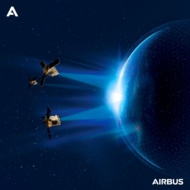
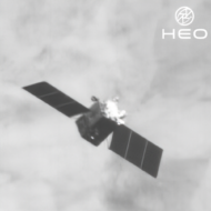
BlackSky ($BKSY) announced a seven-figure deal yesterday that will expand its non-Earth imaging (NEI) partnership with HEO, the Australian space domain awareness company.
The two companies partnered up in September (also to the tune of seven figures), under a deal to place BlackSky’s NEI services within HEO’s sensor network. This week’s deal extends that partnership.
It gives HEO’s software platform—called HEO Inspect—the ability to autonomously task BlackSky’s Gen-2 satellites, which then deliver non-Earth imagery and metadata directly into HEO Inspect.
Working overtime: The expanded partnership also comes with very little opportunity cost to BlackSky, officials explained, because the NEI requests are mostly expected to arrive when BlackSky sats aren’t imaging the Earth.
“BlackSky has the ability to leverage remaining capacity typically associated with satellites passing over the ocean or satellites in eclipse, traveling across the dark side of Earth,” Brian O’Toole, BlackSky CEO, said in a statement. “Customers can now use that excess capacity…to monitor objects in space, with no humans in the loop.”
HEOd on a swivel: Including partners like BlackSky, HEO’s network consists of over 40 NEI sensors. HEO also gathers its own orbital data through seven of its own optical NEI sensors, which fly as hosted payloads aboard partner satellites including Turion’s Droid-1, Impulse Space’s Mira OTV, and Sidus Space’s LizzieSats.
The result is that HEO can offer NEI data on an increasingly wide swath of space.
“Customers shouldn’t have to think about where our cameras are. They should just tell us the object they care about, and within hours we’ll deliver an image and the analysis they need,” Will Crowe, HEO’s CEO, told Payload via email. “[We’re] placing cameras as close as possible to the assets and threats our customers need to see…It’s software first, hardware only where we must, ensuring complete coverage at a cost customers can actually scale with.”
HEO plans to have 60 sensors in LEO by the end of the year, and expects to begin offering NEI coverage of GEO in 2026.


