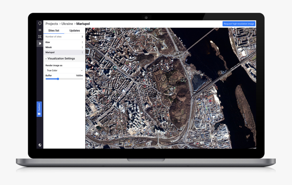
Satellogic has partnered with Astraea, a geospatial and AI analytics company, to quickly supply the Ukrainian government and allied groups with satellite imagery and change detection in the midst of the ongoing war in the country. The two companies said yesterday they’ve created a portal called Ukraine Observer where governments and humanitarian organizations can apply to gain free access to Satellogic’s most up-to-date Ukraine imagery.
Eyes on the conflict: As we’ve written before, satellite imagery is playing a major and unprecedented intelligence role in the Russia-Ukraine war. From the leadup to Russia’s invasion to the outbreak of hot war, civilian observers and intelligence groups have been using satellite imagery to track the movement of troops, flow of displaced people, and damage to crops and infrastructure.
Last week, Ukraine Minister of Digital Transformation Mykhailo Fedorov published an open letter asking Earth observation companies to make their data available to the Ukrainian government as quickly as possible. Satellogic and Astraea are joining the list of companies answering the call.
“We were really desperate to find a way to do something meaningful,” Brendan Richardson, Astraea CEO, told Payload.
About the portal: Ordering satellite imagery is a well-known hassle for small users, and Satellogic and Astraea are hoping to make the process as frictionless as possible through this new front door.
The mechanisms behind the portal are familiar: Satellogic is already tasking its satellites over Ukraine, and that imagery will be available to users as soon as their application to access the data is accepted. Astraea, on the other hand, had the analytics UI built in its EarthAI platform, and hasn’t had to change its software to support this new initiative.
The data that Astraea will provide on the Satellogic imagery varies widely, Richardson said. “It’s change detection, it’s wide area search, it’s monitoring activity, whether that’s construction activity or infrastructure building or infrastructure destruction of war, burning of vegetation, all kinds of things that might relate to either military activity or large movements of people.”
Vetting: As important as it is to get critical information to the right people as soon as possible, it’s just as important to keep it from falling into the wrong hands. Groups looking to access satellite imagery are required to fill out a questionnaire.
- They’ll be vetted using Know Your Customer (KYC) protocols, which will verify that only legitimate humanitarian organizations can gain access to the data.
- For cleared governments and groups, the satellite imagery and data will be available on a streaming basis only and not downloadable.
Commercial entities can apply to purchase the same data on a weekly or monthly basis, but are subject to the same vetting procedures. Groups that purchase the data will be able to download it. Satellogic and Astraea are still working to determine pricing for commercial users.
The upshot: Time is of the essence in an active military conflict, and providing timely satellite imagery and data is a challenge that has to be faced as quickly as possible.
“This is really an experiment to figure out the most efficient way to get the most relevant imagery data into the best hands and do the most good with it as efficiently as possible,” said Richardson. “Our hope is that people come and start using the portal, and then we get lots of feedback on how to improve it or how we can make it more efficient.”


