

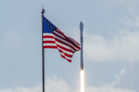
Rocket Lab ($RKLB) is expected to launch four Spire-built satellites on Wednesday for NorthStar Earth & Space that will collect space situational awareness data on objects in LEO. The constellation is a bet on a robust market for privately-collected space traffic info.
With the launch of the new TraCSS pathfinder last week, we’re closer than ever to seeing the government deploy commercial capabilities to fulfill the Department of Commerce’s mandate to create a public database of space activity.
It’s not just to give DOD a rest from tracking the ever-increasing amount of stuff in orbit and focus on military objectives; it’s also that private SSA is more accurate than what the government is providing. Last year, the GAO found that the Space Force lacked a coherent plan to use commercial data and, as a result, used it sporadically.
It’s the maneuvers, stupid. One source of error (pdf) in current SSA is when spacecraft move for station-keeping purposes or to dodge a potential conjunction. Space Force trackers don’t receive information about maneuvers or may have trouble modeling them.
Satellite operators have a solution—the Space Data Association, a clearinghouse for voluntary information created in 2009. During a Commerce Department trial in 2022 focused on GEO satellites, COMSPOC assessed its accuracy (pdf) was seven times better than the current standard thanks to its use of data from the association.
It’s the data. Military space trackers depend on the “Space Fence” radar built by Lockheed Martin ($LMT) (and, likely, some classified sensors as well). But commercial data sources, like LeoLabs’ six radar sites around the globe, Slingshot’s 150 optical sensors, or the on-orbit data collected by the new NorthStar constellation or Maxar’s Non-Earth Imaging sensors, among others, can provide more frequent observations and tracking than the DOD alone.
And it’s the software. COMSPOC says its software was three times more accurate than legacy systems while tracking six MEO GPS satellites in 2022, even without user data. LeoLabs CEO Dan Ceperley said not to underestimate the complexities of managing the data flow from multiple sensors and collating it into timely and useful information.
Last year’s GAO report detailed how Guardians struggled to take advantage of commercial data “because the legacy systems were never designed for data sharing or connecting to a network.”
SpaceX Alum Have Raised $9.2B, New Data Shows
As an organization that’s employed thousands of engineers in its 24-year history, SpaceX has acted as both a breeding ground for high-level engineering talent, and as a launch pad for new ideas.
Firefly Acquires Autonomous Space Ops Company
Firefly Aerospace announced yesterday that it acquired Space-ng, which is an AI-powered vision navigation and autonomous guidance systems provider.

Satellite Operators Launch Trade Association
Amazon, Globalstar, Iridium, and Canada’s Telesat joined together to establish the SpaceConnect Association for NGSO operators.

SpaceX Starfall Demo Provides Validation for Reentry Startups
SpaceX ($SPCX) launched a demo mission of its Starfall reentry capsule yesterday, kicking off a new era of competition in the budding reentry sector.

The Ligado spectrum rights saga continues.
The US government filed a motion to dismiss Ligado’s lawsuit over spectrum rights last week, challenging the court’s jurisdiction and disputing the satcom provider’s claims.
Origin story: In 2020, the FCC authorized Ligado’s use of the L-band spectrum, green-lighting its plans for a terrestrial 5G network. The company said it spent billions of dollars to secure the license.
Keep reading