Not all orbits are created equal. Satellite operators have many options when deciding where to send their birds, each offering tradeoffs in Earth coverage, image resolution, data download latency, orbital congestion, and launch costs.
Military, commercial, and climatological interests have increasingly picked polar orbits for a variety of missions, from surveillance and communications capabilities over remote regions, to better understanding the rapidly evolving impacts of climate change on the polar ice caps.
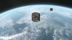
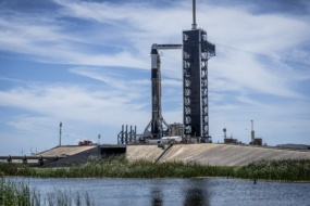
From OneWeb 20, expecting to launch on Falcon 9 this week, to SpaceX’s crewed Fram2 mission, which could launch as soon as this year, there’s been a notable uptick in the amount and scope of missions heading over the poles.
Polar pros: Polar orbits bring a unique blend of capabilities that make them extremely attractive to operators attempting to cover the whole planet and map various climatological trends over time.
- Full Earth coverage: A satellite flying over the top of the poles while the Earth rotates beneath can pass over the entire planet in a single day, and revisit sites frequently. This gives polar orbiting satellites an advantage over equatorial or geosynchronous orbits, which are blind to large swaths of the planet and require constellations for full coverage.
- Arctic activity: As climate change quickly melts the arctic ice cap, it’s becoming increasingly important for weather satellites to map and understand the ecological changes happening in the Arctic Circle. With less ice each summer, the region is becoming more accessible for the global mining and commercial fishing industries. As a result, there’s been an increased financial and military focus on the region.
Polar cons: That said, it’s not easy to get satellites into polar orbit, and it can be even harder to keep them there.
- Launch: Placing satellites into polar orbit requires more fuel, as rockets have to launch at an angle perpendicular to the rotation of the planet. This makes launching to polar orbit more expensive and limits the jumping off points to only a handful of spaceports that can send rockets in a north-south trajectory.
- Collision risk: While there are fewer satellites flying over the poles compared to other orbital lanes in LEO, there remains a significant risk of being T-boned, as polar satellites cross through some of the most congested orbital bands. Satellites in polar orbit need to have dynamic capabilities to maneuver out of the way of crisscrossing traffic, which further adds to operators’ cost and complexity and can quickly reduce the on-orbit lifetime, as a high number of collision avoidance maneuvers can quickly exhaust limited fuel reserves.
- Staying in touch: Polar orbits can sometimes face longer latency times when sending data to Earth because there are simply fewer ground stations at higher latitudes. To remain in constant communication, polar satellites will often have to use relay satellites to beam time-sensitive data back to Earth.
Polar past, present, and future: Placing satellites in polar orbits is nearly as old as the space race itself. The first satellite to fly over the poles, Discoverer 1, was a US spysat launched in 1959 tasked with monitoring Soviet missile buildup.
Polar orbits have remained vital for military surveillance and early warning detection, global communications networks, and advancements in weather prediction and climate monitoring. In all of these use cases, governments and commercial interests have maintained a constant presence over the region, pushing technical innovations with each successive constellation.
After Discoverer 1, the US launched Echo 2, the first communications bird in near-polar orbit. While other satellites had already demonstrated on-orbit communications technology, Echo 2 offered one of the first two-way communications capabilities, allowing a JPL facility in California to connect with a Bell Telephone Laboratories facility in New Jersey.
The first weather monitoring satellites launched in the early 1960s, as part of NASA’s TIROS program. TIROS-9 was the first of these to travel in polar orbit, capturing the first complete view of the world’s cloud cover by aggregating 450 images of the planet.
Since then, the number of satellites in polar orbits has ballooned. Together, Iridium and SpaceX Starlink have over a hundred satellites in polar- or near-polar orbit and offer satellite communications coverage to nearly every corner of the planet.
Industry has taken notice of this trajectory and is responding accordingly by building pads that can reach the polar trajectory.
SaxaVord Spaceport in the UK came online this year and offers the capability to launch rockets to polar orbit. While its first launch by RFA ended in explosion on the launch pad, the facility will soon be able to send a flurry of rockets and satellites over the poles.
Additionally, both Canada and Maine are working on building polar launch capabilities, through the NordSpace and the proposed Maine Spaceport Complex, respectively.
Tracking the climate: Since the 1950s, satellites in polar orbits have been critical for meteoritical monitoring—and while the number of these satellites may remain relatively flat, the quality of data they collect has increased with every new generation. EUMETSAT and NOAA operate a handful of satellites in both geostationary and polar orbit to provide an accurate picture of both short-range and long-range weather forecasts.
As Gareth Williams, the head of flight operations at EUMETSAT explained, satellites in polar orbit are a crucial piece of the puzzle.
“Geostationary—the big picture—is used primarily for short term weather forecasting, what’s called now casting….And then you have the data from the polar satellites, which are primarily used to feed the numerical weather models that come up with the weather forecast for out to 10 days into the future,” Williams told Payload. “These two things together give you what the weather is, what it’s probably going to be quite soon, and then what it’s predicted to be going forward days in the future.”
The next generation of EUMETSAT’s Metop satellites, expected to launch next year, will gather a wide range of data:
- Infrared: Tracking ground and ocean temperatures, detecting fires, and tracing the direction and power of hurricanes
- X-Ray: Offering the ability to see through the clouds, and spot and analyze precipitation, including rain and snowfall.
- Radar: By broadcasting a radar signal down to Earth, a scatterometer can determine wind speed and direction, as well as information about the ocean and atmosphere.
- Sounding instruments: Measuring temperature and humidity levels.
- Other instruments: Detecting and measuring aerosols in the atmosphere can judge the composition of the atmosphere over time, which is crucial for studying climate change.
Military applications: Polar satellites don’t just track the weather. Since the early days of the space race, they’ve been crucial for militaries to keep an eye on one another.
The US military has many assets over the poles, which provide the US with early warning systems, communications capabilities, and surveillance in infrared, synthetic aperture radar, and standard EO technologies, a Space Force official told Payload.
As the Arctic region has grown warmer, it’s also become busier, and the rise in geopolitical tension with Russia and China has pushed allied militaries to increase their power projection in the Arctic region, the Space Force official said.
The result has been a greater focus on collaboration and information sharing between the US and its allies.
- In August, Norway became the first allied nation to launch a US military payload, with the explicit purpose of providing more communications coverage over the Arctic.
DoD’s Arctic Strategy, released this year, laid out a need for that presence to grow, saying that the military’s space domain awareness in the region was due for an overhaul to meet the growing commercialization and the increasing threat from adversarial powers in the region.


