
Albedo Space recently announced that it has closed a $48M Series A round, co-led by Breakthrough Energy Ventures and Shield Capital. The startup also has other heavyweights on its cap table, such as Y Combinator, Initialized Capital, and Joe Montana. (Happy NFL Kickoff day to all who celebrate.)
Albedo’s spiel
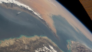
The Austin- and Denver-based startup is building satellites that will fly in very low-Earth orbit (VLEO). By flying so low, Albedo’s birds could theoretically collect optical imagery that’s 10X better than what’s commercially sold today.
But the company still has to prove that theory—and its technology—in practice. The good news for Albedo is that its first satellite is now fully funded. A couple years of heads-down building and grinding remain.
Albedo currently has a headcount of 21, but expect that number will grow in the coming months. Around half of the startup’s team is based in either its ATX or Denver hubs, with the rest in the cloud (aka distributed).
Payload recently caught up with Albedo cofounder and CEO Topher Haddad to discuss the road ahead, from the launch of its first satellite to the buildout of a full 24-bird constellation. NB: This interview was edited for clarity and length.
Thanks for the time, Topher. What does it mean to you to have Breakthrough and Shield lead this round?
Having Breakthrough and Shield co-lead our round is a great reflection of the breadth of applications our imagery will enable. Precision agriculture, forestry management, power line wildfire prevention, and defense & intelligence are some of the core markets that need high-res optical and thermal imagery.
On top of that, the company-building experience and industry knowledge that both teams bring will be invaluable in supporting Albedo’s growth.
This $48M round brings you to $58M total in fundraising so far. And you’re less than two years old. What do these numbers signal, in you and your investors’ confidence to get hardware on orbit? Does this fully fund launch #1?
Yes, it fully funds us through the first satellite launch.
Behind the scenes, this involves a lot of development work on flight software, algorithms, vehicle design…a lot of the challenges and implications of VLEO.
We’re working through the approach, where we’re able to achieve this image resolution by essentially cutting the altitude in half from a normal imaging satellite. There’s a lot of challenges that come with that and new technologies that we’re developing to do it.
So, basically it’ll fund us through that kind of development effort, plus developing the first satellite of our constellation.
Walk us through the advantages of your approach.
Essentially, with the physics of imaging, you have just two knobs to work with.
You have the distance to the target and the diameter of the lens or telescope or whatever. For space telescopes, the bigger they get, the more exponentially complex and expensive they get. This is why nobody’s done 10 cm before, even though the value is obvious. To get that resolution currently, you need drones or planes.
If we can cut that distance in half from space, we can shrink the size of the diameter and get high resolution at a price point that works for the commercial market. Technologically, there’s a lot of enablers that will help us do that. Some have reached a performance point that we can use, which aren’t developed in-house. But we are developing other technologies in-house, related to both VLEO and the resolution of the system itself.
The advantages of your approach are clear, but what about the drawbacks? I suppose a couple of them would be fuel and drag.
Exactly, and that’s important.
One example of how we’re tackling that is electrical propulsion. The fuel with that technique is much more efficient and enables us to compensate for that drag and stay up.
A lot of the proprietary flight software we’re developing is related to the pointing, control, and stability of the satellite and the platform. That’s important for really high resolution imaging. Your angle is so narrow and much more challenging when you’re flying really low.
There’s that, and a larger mass, which helps when you’re flying really low. You can picture a bowling ball versus a golf ball flying through the atmosphere. Finally, with lower launch costs, you can launch bigger systems into space.
Is the big equation for you $/kg?
The launch costs are related to mass, but not as important as the cost reduction in shrinking the diameter of the telescope.
Can you say a bit more about electrical propulsion?
It’s been around for a bit and the typical downsides are low thrust. You can’t get anywhere quickly. If you’re trying to go from LEO to GEO, just using electric propulsion, it takes a long time. The benefit is it’s really efficient, so your fuel lasts a lot longer.
For a mission like ours—imaging—we don’t really need high thrust. We can utilize the efficiency of the fuel, by compensating for the drag and just kind of having the thrusters turned on when we’re not imaging. We’re steady and staying afloat in the atmosphere as we’re orbiting around.
What’s the expected lifespan of your satellites?
Lifespan will be limited by propellant, given the drag in VLEO. And the drag environment fluctuates throughout the 11 year solar cycle. Averaged over that timeline, the nominal lifetime is comparable with other new space satellites. To provide additional optionality, our satellites will contain the RAFTI fueling port from Orbit Fab, which will give us the option to either refuel or replace at the end of the nominal lifetime.
What bespoke work needs to go into the launch of the first satellite, which will then be baked into future production units?
The initial technology development: flight software, algorithms for GNC, and some of the other technology we’ve already discussed. The design, prototyping, and testing to develop this first VLEO system. Once we get the technology demonstrated and the first satellite up, then it’s a bit more of a production line-type approach. We don’t need, nor are we targeting, a massive constellation. We’re not the type of mission that takes a megaconstellation approach.
So, what’s your criteria for a constellation? How is the determination of that number, a critical mass I suppose, tied to end-user applications?
The first constellation milestone is at six satellites, when we’ll have daily revisit capabilities for a customer’s area of interest. Most of our customers are interested in weekly and monthly imaging cadences. And 24 is our working number for the full constellation right now. 24 satellites enable up to four revisits per day to areas of interest.
A lot of our use cases, like weekly monitoring of crops or monthly imaging of power lines, don’t require ultra-high revisit approaches.
It’s resolution, not revisits.
Exactly.
What I’m struggling to conceptualize is how you’d have everything covered with six satellites.
This is where the nomenclature that the industry uses can be confusing. It’s the ability to image everywhere daily, but not that we are imaging everywhere daily. It’s the access. If we’re passing over, say, Manhattan, we can image Brooklyn but not New Jersey. It’s that kind of thing. So, it’s not the Planet daily scan approach, where they are imaging the entire land mass daily. At this resolution, you’d need a thousand satellites to do that.
Yeah, and you’d have a very, very large AWS bill.
Right.
Let’s get into use cases.
I think the best starting point is looking at a lot of applications and markets that have been limited to aerial imagery or drones to date. A big one that needs higher resolution is precision agriculture. That’s where our VLEO platform could come in handy, especially when we combine with thermal infrared imagery and can measure moisture. It adds another layer of information to determine the health of crops, improve irrigation processes, and so on and so forth.
For standard optical imagery, having that resolution is really important early in the growing season. Being able to accurately monitor health—along with another unique thing for us, which is collecting very small areas from tasking—is very unique. We can image small crop fields and we don’t require a really large minimum order size. So that’s also very useful.
Power lines are another big one. You can do wildfire prevention and vegetation management around power lines. Thermal is also very useful for that.
Mapping and property insurance won’t be as much of the early go to market, but have historically been pretty limited to aerial imagery. You need to be able to read road markers, detect the health of roofs, or accurately characterize the property for insurance.
Finally, there’s defense and intelligence, obviously, and being able to develop sufficient detail for that.
I’d anticipate that demand would outstrip supply, at least for the foreseeable future. How would you prioritize? Willingness to pay?
I mean, it’s hard. Essentially, the goal is to have standard pricing and a reliable and transparent user interface. Customers will know whether we can get their image or not, and that they’re not tasking a black box.
It will take time—for us to get up to four, six, eight satellites—before we can really serve a lot of customers. As long as we’re supply-limited, you know, that will help us accelerate deployment.
Explain your pricing strategy.
We made a commitment early on that we will always have our pricing transparently listed on the website. Given the unique pointing and collection capabilities of our system, we plan to announce additional pricing options in the future to enable more affordable tasking of very small image areas, different from the traditional $/sq. km pricing models.
I’d be remiss to not mention the 10 cm number at some point in this conversation. This isn’t staged, I have this sitting on my desk. <Ryan holds up one of his drones to the webcam> If you succeed in what you’re setting out to do, are you ‘gonna put all these drones out of business?
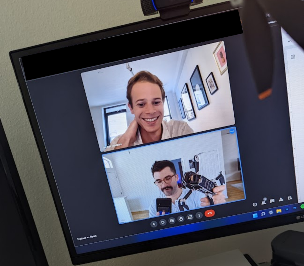
<Topher laughs + looks confused>
Let me rephrase. To what extent will like enterprise drones and Cessnas be your competitors, as opposed to LEO imagery providers?
I think the main category of competition is aerial. You can fly a drone tens of feet above a roof and get that really detailed 3D inspection. We’ll never be able to do that from space.
But, you know, we’ve talked to customers who say: “10 centimeters is fine. We just keep crashing our own drones. We don’t want to train drone pilots.” There’s a manually intensive aspect of it.
Ultimately, though, it’s the aerial flights that are really expensive. You have to plan them out and you can’t do it on demand. That will ultimately be challenged in the future, if we’re successful.
The last time you and I chatted at length, Albedo received the NOAA license to sell 10 cm commercial imagery. A huge derisker for you. But not really a competitive moat, right? Nobody on the commercial side has gotten down to 10 cm?
To my knowledge, the capability doesn’t exist from space commercially.
Best in class is 30?
Yeah. 30 centimeters. Maxar and Airbus do 30 cm.
It’s really the technology, price, and traditional approach of driving a Hubble-sized space telescope that have limited companies from going this high-res in the past.
Back to the regulations, they’re an enabler. But they haven’t been a limiter in the past.
The license is huge, and it’s a massive milestone for us. The key challenge [for Albedo] is the technology.
Any info you can share on a launch timeline?
We plan to announce launch dates as we get closer. Our first full satellite will both demonstrate our novel technology and deliver imagery to select customers. We’ve already closed binding pre-orders for our imagery.
ORBES Unveils Exo-ORB Maintenance Spacecraft
Exo-ORB is a ~12U, sub-26-kg spacecraft that’s designed to launch on-board customer infrastructure for ready-to-go inspection.
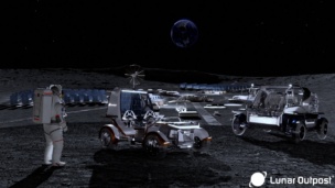
Lunar Outpost Plans to Fly NVIDIA Chips to the Moon
The chip race and the race back to the Moon race have just crossed paths.
Intel Authorization Act Proposes Limiting Commercial EO Access
EO data is a privilege, not a right, and the US government wants to control what EO satellite operators can and can’t share with the public.

The UK and Space Florida Launch Joint Fund
The new fund supports projects with at least one partner headquartered in each region.
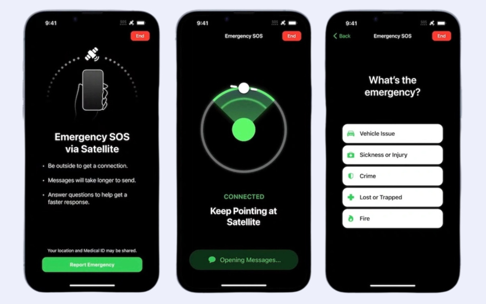
Apple unveiled the iPhone 14 on Wednesday and it turns out the rumors were true. The Cupertino consumer device giant will add satellite connectivity into the next generation of its best-selling product.
As one satellite industry executive put it to us, “this was the worst kept secret in the industry.” Now, the cat is out of the bag.
Direct-to-phone satellite links will work for Apple’s forthcoming “emergency SOS” service. The service will support a preselected set of prompts, when a phone is out of range of cellular coverage and doesn’t have Wi-Fi. The iPhone will be able to send an emergency SOS message if the device has a clear view of the sky and has line of sight with a satellite.
Keep reading