
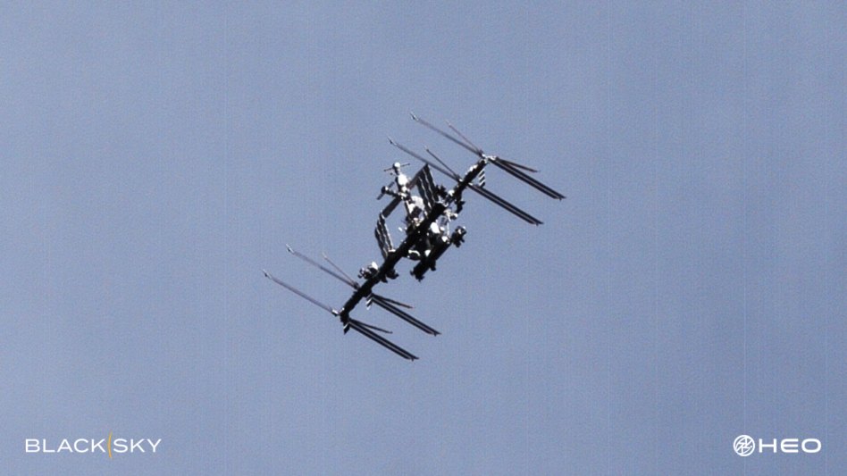
BlackSky ($BKSY) will incorporate its geospatial imagers into Australian non-Earth imaging startup HEO’s sensor network under a seven-figure contract signed this week, the companies announced today.
At a time when orbital freeways are becoming increasingly congested with thousands of new satellites entering orbit each year and the ever-growing mass of space debris, intel collected by non-Earth imaging (NEI) sats provides greater space domain awareness for defense and commercial assets on orbit.
You’re going that way anyway: The deal gives HEO the opportunity to utilize BlackSky’s extra capacity, as NEI functions can be performed when BlackSky satellites are drifting over the ocean, or across the dark side of the Earth, when imaging the planet is impractical.
Adding BlackSky into HEO’s network brings the Australian company’s total constellation—which also includes imagers from Satellogic, Axelspace, and one of HEO’s own NEI cameras as hosted payload on a Turion bird—to 46 satellites, according to Nate Notargiacomo, head of HEO’s US branch.
BlackSky’s constellation is expected to significantly increase the availability of timely, high-resolution NEI data, and it will give the company more coverage over the middle latitudes of the planet. The eventual aim is to have complete coverage around the Earth.
“We’re always looking to increase. So we have a goal to have about 100 EO sensors by 2025, and that should really give us solid coverage up to about 1000 kilometers around the globe,” Notargiacomo told Payload.
While these imagers are optimized to spot objects in space about a meter cubed in size, HEO has been able to capture images down to 2 cm in resolution, Notargiacomo said.
There’s an API for that: The contract seeks to automate the entire process, from tasking to data delivery.
HEO customers will be able to request NEI data in the company’s platform—HEO Inspect—which will then automatically schedule BlackSky satellites and deliver photos alongside detailed analytics on the orbiting object’s location, attitude, subsystems, and pattern-of-life.
“Automatically tasking and receiving NEI products reflects yet another pioneering innovation that gives customers reliable and actionable space-based intelligence about spacecraft or on-orbit objects of interest at mission speed,” BlackSky CEO Brian O’Toole said in a statement.
Rocket Lab Enters the Thruster Market with Gauss
“Early technology development can be done at these small mom and pop shops, but when it really comes prime time to make things at scale, people like ourselves who are procurers of that, if they don’t vertically integrate, they get very nervous,” Rocket Lab CFO Adam Spice told Payload
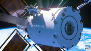
Voyager Technologies Wins Its First Private ISS Mission
Axiom Space was the only provider for the first five PAMs awarded by NASA, but new players have entered the competition in 2026.

ORBX ETF Launches Amid Wave of Space Tech IPOs
The goal is to track companies that earn more than half of their revenue from space tech—everything from transportation, to space software, to satellite-enabled data services.

Slingshot Introduces AI-Powered Portal Platform
Slingshot Aerospace introduced a new platform today that will allow operators to spot anomalies—and make decisions—in an AI-powered, one-stop-shop.
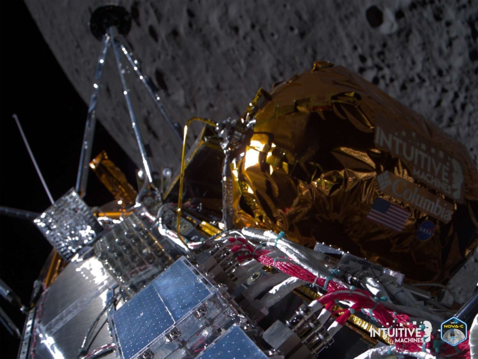
NASA awarded Intuitive Machines ($LUNR) a long-term contract potentially worth $4.82B to develop, launch and operate a five-satellite communications and navigation network around the Moon.
The network will enable constant connectivity with the Moon’s south pole as traffic picks up there, first for landers and rovers, and then for crewed missions as part of Artemis. The contract builds on the company’s manifest, which includes three NASA-funded robotic lander missions under the Commercial Lunar Payload Services (CLPS) program, with another expected to follow.
“We were in a strong position with a ground network, and with the ability to rideshare and bring satellites with us [on] this regular cadence of missions, we could deploy a constellation of satellites around the moon,” Steve Altemus, the company’s co-founder, president, and CEO, told Payload.
Keep reading