

German thermal remote sensing startup ConstellR has acquired Belgian hyperspectral startup ScanWorld to offer better agricultural insights for end users. According to ConstellR, ScanWorld’s hyperspectral product development know-how will complement its own thermal infrared and data processing capabilities.
- Both companies were founded in 2020 with the aim of offering Earth observation (EO) data to the agricultural industry
- In October 2021, the companies signed a memorandum of understanding to combine EO expertise
- This week, ConstellR acquired ScanWorld
With the acquisition closed, ConstellR expects to launch its first public-facing product within a month. It will offer a harmonized data stream integrating observations from Landsat, Copernicus, and the company’s own proprietary data, with a focus on water monitoring.
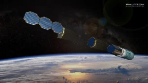
The ConstellR constellation
Currently, the company has a single asset in orbit, launched to the ISS via a Northrop Cygnus cargo spacecraft in February. But ConstellR has a roadmap to launch a pair of constellations that will offer proprietary thermal and hyperspectral observations:
- The first independent thermal system will be launched towards the end of 2023.
- That first system will be joined by three more, enabling daily revisit capabilities.
- The first hyperspectral systems will be launched starting from 2024.
In the future: Despite its disciplined ag focus in the near term, ConstellR hasn’t ruled out expansions into other verticals down the road.
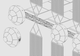
Phantom Space Acquires Thermal Management Technologies
Thermal Management Technologies builds advanced satellite thermal components for in-space applications.
Exclusive: In-Orbit Manufacturing Startup Dispatch Emerges from Stealth
Dispatch emerged from stealth this week with $500,000 in funding to build an uncrewed space station that will host manufacturing infrastructure on orbit

Voyager and Icarus Team Up on ISS Robotics Demo
The pages of the ISS manifest are starting to look a lot like those of a sci-fi novel.
Transporter-16 Sends 119 Payloads to Orbit
The latest cargo train to orbit has left the station.

The future of space tourism may look nothing like the sterile, utilitarian white rooms imagined in the sci-fi staples we grew up with. Instead, it could be comfortable, familiar, and focused on fostering human connection and empathy, according to Space Perspective cofounder, co-CEO and CTO Taber MacCallum.
Space Perspective: The space-tourism-via-balloon startup aims to capture the essence and experience astronauts have of spaceflight. “When you talk with astronauts about their experience, they don’t talk about the microgravity, the rocket ride…what they talk about is hours spent at the window looking at the Earth below,” said MacCallum.
“That’s the quintessential experience.”
Keep reading