
We have arrived at a new era of geospatial intelligence – one defined by greater transparency and more data than ever. Let’s talk about how we got here, and the role Planet has to play.
Recently, Planet authored a white paper that explains how and why the commercial space industry has grown so rapidly, and how it’s creating a new era of geospatial intelligence. Today, we’re taking a sneak peek into this work.
The case for increased open-source observation
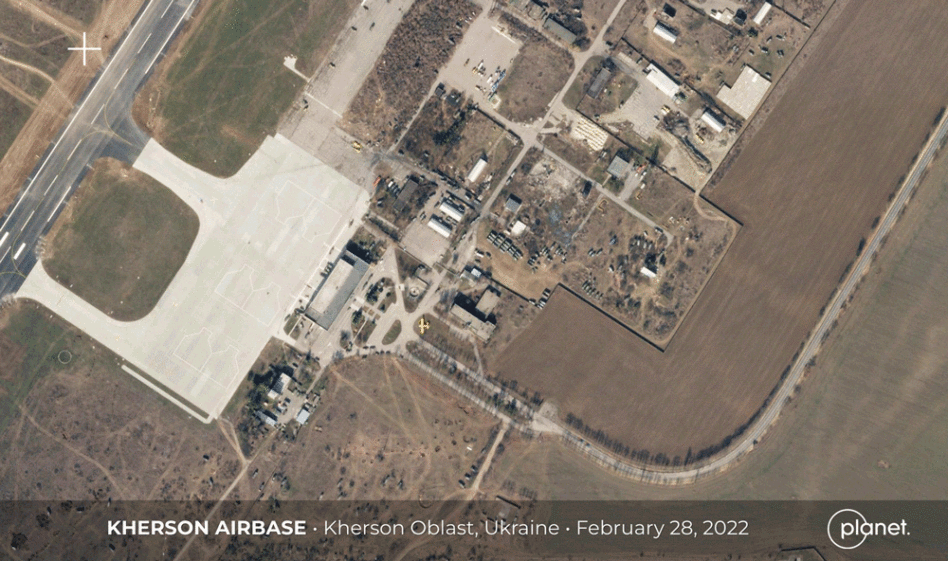
In late 2021, news outlets around the world reported a massive buildup of Russian military forces near the Ukrainian border in Crimea, western Russia, and Belarus.
Open-source satellite imagery showed a drastic increase in the volume of troops, military infrastructure, and vehicles amassing in this region, underscoring fears by various governments that a military incursion into Ukraine was imminent.
During this time, the importance of commercial satellite companies became clearer than ever before, highlighting the power of transparency and collaboration during what has become the most digitally documented invasion in history. Through the first two weeks of the invasion, the Ukrainian government received data covering more than 15M square miles of the war zone, and national intelligence agencies more than doubled their procurement of commercial electro-optical imagery.
Access to such current data with a high-cadence historical archive allowed for more outreach, evacuation planning, increased situational awareness, journalistic documentation, and critical decision making in impacted areas.
The visibility into this war redefines our understanding of ground truths during active conflict. Commercial satellites not only play a role in delivering insight into happenings on the ground; they will continue to be pivotal once the conflict is resolved and analyzed by national governments, international non-governmental organizations, and defense and intelligence agencies to verify the date, time, and location of war crimes and human rights violations committed.
How Planet Analytics Feeds points to the needle in the haystack
In traditional intelligence scenarios, satellite data was analyzed manually—a task comparable to looking for a needle in a haystack. This approach is error-prone, cumbersome, and takes up way too much of analysts’ valuable time.
Planet has developed a tool using advanced machine learning algorithms and AI that can detect changes in objects of interest, including vessels, aircraft, road, building, and land cover. It not only delivers the haystack of satellite images for analysis; Planet’s Analytics shows you where to find the needle.
Change detection feeds have been used to help verify damage of airplanes on the battlefield, identify construction of covert nuclear weapon facilities, counter misinformation campaigns, call out human rights violations, assist in humanitarian crisis mitigation, track smuggling “dark” ships, and even predict agricultural yield on the frontlines of war.
Understanding the growth in the commercial space industry
“Twenty years ago, space launches were a very government-dominated capability. Now, there’s much more room to innovate,” Josef Koller, systems director for the Center for Space Policy and Strategy at The Aerospace Corporation, said in an interview last year with NBC News.
Since the first successful satellite deployment in 1957, the number of satellites placed into orbit has increased steadily, if not dramatically, each year. Between 2000 and 2022, the number of commercial EO satellites in orbit increased from roughly 10 to over 1,000.
The story of intelligence-gathering satellites began with individual governments locked in highly secretive competition. But today, a new chapter is unfolding: one defined by transparency, collaboration, and the vital importance of commercial private enterprise.
In the 2000s, the opportunities of commercial space became even more clear to a number of visionary aerospace engineers and business leaders. Among them were the founders of Planet.
Planet’s approach to satellite construction has leant them a unique edge in the design, build, and operation of a unique Earth-imaging satellite constellation currently the largest in orbit with roughly 200 birds in operation. A research and development methodology that Planet’s founders helped develop, known as Agile Aerospace, is what made that impressive feat possible.
A Faster Path to Orbit: How Hosted Payloads Are Changing Access to Space
Historically, deploying a new capability in space required significant time, investment, and technical expertise. Companies often had little choice but to build nearly everything themselves—from spacecraft and payload integration to ground infrastructure and mission operations. Today, the space industry offers a different model: hosted payloads. “We’re seeing companies looking for the fastest, most economical way…
Mass Is the Easy Part, Coordination Is The Hard Part
Ukraine rewrote the economics of conflict. When an adversary can field cheap drones by the thousand every month, you can’t answer them with million-dollar interceptors and exquisite platforms, you answer mass with mass. The U.S. has absorbed the lesson and is building autonomous, disposable systems faster than it ever has, led by a new generation…

From Design Reviews to Decision Intelligence: CoLab Rewires Engineering Workflows
In engineering production, hundreds—sometimes thousands—of decisions stand between initial concept and final product. Some decisions are big, and some are small trade-offs, but collectively, they determine whether a program moves forward efficiently—or stalls under the weight of its own complexity. Those stalls often stem from an inefficient process of how design decisions are made and…
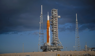
Beyond the Rocket: The Digital Infrastructure of the Artemis II Mission
When Artemis II lifts off, the world will see a rocket. What it won’t see is the digital architecture that makes the mission possible. “It [Artemis] may look similar up there on the pad, but it’s completely different from Apollo,” said Karen Fields, vice president and NASA account lead at Booz Allen. “The vehicle is…
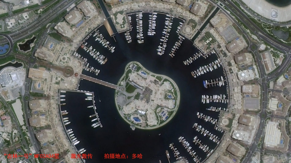
Chang Guang, a Chinese satellite operator, successfully achieved 10 Gbps satellite-to-ground laser communication via a Jilin-1 satellite, the company announced last week. The downlink speed surpassed a previous record of 1 Gbps via radio frequency connectivity.
The first laser demonstration downlink included a satellite picture of Doha, Qatar.
Beam me down, Scotty: Laser communication’s higher frequencies enable significantly faster data transmission compared to traditional radio waves, although excessive cloud coverage can impact connection to laser ground stations.
Keep reading