
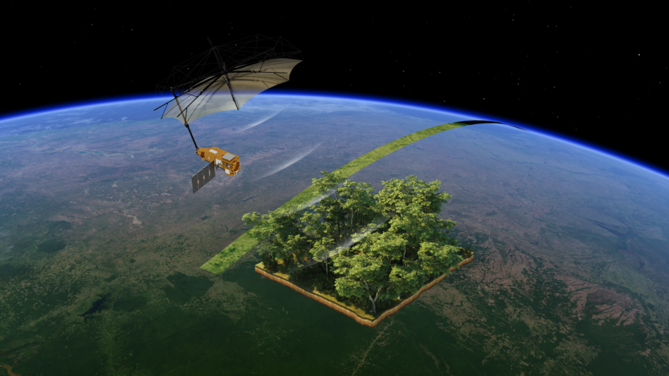
Europe will launch a satellite to map the world’s forests in 3D, to hunt down illegal logging and track climate change by mapping how forests store carbon.
How it works: The satellite, called Biomass, will carry a novel radar that has not flown in space before. The instrument, fitted with a 12-m (39-foot) wide antenna, emits a low-frequency electromagnetic signal that penetrates even the thickest rainforest canopy.
Scientists will use the measurements to reconstruct tree stem and branch thickness to better understand how much carbon is stored in the planet’s tree cover.
“The Biomass satellite represents a major leap forward in our ability to understand Earth’s carbon cycle,” Paul Bate, CEO of the UK Space Agency, which is helping to fund the mission, said in a statement. “It will provide critical insights into how our planet is responding to climate change — helping scientists, policymakers, and conservationists take informed action.”
Mission specs: The mission aims to create a complete 3D map of the world’s tropical forests in 17 months. Repeated measurements during the five-year mission lifespan will uncover trends in the life of the forests—including the scope of illegal logging and deforestation.
The €470M ($535.1M) mission is funded by ESA, with contributions from 20 of the agency’s member states. Airbus Defense and Space led the construction of the sat, which also included contributions from 50 companies.
Mark your calendars: Biomass will launch from the European spaceport in Kourou, French Guiana, on Tuesday atop the European Vega-C rocket. The launch will be only the second for Vega-C since the 2022 failure.
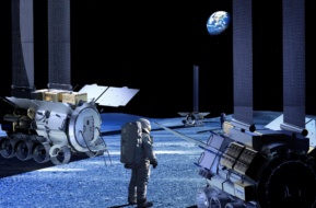
Astrobotic Wins Lunar Wheel Contract For Italian Habitat
The Pittsburgh, PA-based space firm won a contract of undisclosed value from Thales Alenia Space to contribute the wheels for Italy’s Multi-Purpose Habitation.

Space One Rocket Fails Third Consecutive Flight
Japan’s dream of setting up reliable commercial access to orbit suffered a major setback this week.

Seraphim Space Investment Trust Posts Record Results
Seraphim Space Investment Trust ($SSIT) announced its financial results for H2 2025, revealing a successful portfolio of global space businesses that have seen valuations buoyed by geopolitical trends.
Viasat and Space42 Share Strategy for Equatys JV
The two companies cancelled a key roundtable at the Mobile World Conference, but Viasat CEO Mark Dankberg gave Payload an exclusive rundown.
Katalyst acquired Atomos in a bid to grow its in-space servicing business, the companies announced today.
Under the acquisition, which closed last month under undisclosed terms, Katalyst will continue using Atomos’ Broomfield, CO-based spacecraft factory. Several members of Atomos’ team, including cofounder Vanessa Clark, will join Katalyst.
“We’re excited to integrate Atomos’ technology and team to build towards a combined vision centered around rendezvous and proximity operations (RPO),” Katalyst CEO Ghonhee Lee said in a statement. “Their heritage complements our DoD traction, and together we’ll enable more rapid and reliable servicing missions.”
Keep reading