

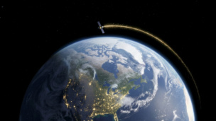
Lockheed Martin and Nvidia are joining forces to develop a global weather digital twin for the National Oceanic and Atmospheric Administration (NOAA), the two companies announced Thursday. The AI-driven earth observation system will help NOAA monitor and increase global weather conditions, including extreme events increasing in frequency.
Digital twin, you say?
Digital twins are virtual representations designed to accurately depict a physical object or system. The ability to run precise simulations, modeled on real-world environments, is the value driver here. Digital twin models are gaining popularity in fields ranging from product design to logistics, and applying them to planetary-scale phenomena is apparently no exception.
Why NOAA? The agency currently collects its Earth system data from a large number of disjointed sources, requiring vast amounts of work from administrators and researchers to stitch everything together and create a cohesive picture. The Lockheed-Nvidia digital twin will use satellite and ground-based sensor data to deliver a real-time, accurate, and high-res model of global weather conditions.
The first data point to come online will be sea surface temperature by September 2023. Sea surface temperature is an important indicator of ocean health, and can alter fish behavior, increase coral bleaching, and disrupt coastal weather.
More on the partnership: Lockheed Martin’s OpenRosetta3D platform will use machine learning modelsML to merge multiple data sources, while NVIDIA’s Omniverse Nucleus will convert the data to a universal simulation. The data will then travel to Lockheed’s Agatha, an Earth-centric 3D visualization platform, for NOAA to analyze.
This isn’t the first collab between the duo. Lockheed and Nvidia are already pairing these technology systems in an effort to help firefighters predict, detect, and fight wildfires.

Advanced Navigation Raises $110M Series C
Not many space companies want to reduce the world’s reliance on satellite infrastructure, but that’s the pitch that landed Australia-based Advanced Navigation a $110M Series C.
Nvidia Unveils New Hardware to Unlock Orbital Data Centers
Orbital data centers may be just over the horizon, but we’re starting to get a better picture of what they’ll look like when they arrive.

ICEYE Smashes Its Own Revenue Projections
ICEYE’s results reveal a massively successful year for a business in the right place at the right time.
Mantis Space Emerges from Stealth with $10M Seed
Mantis Space is aiming to bring power into the light—and now it has the money to do so.
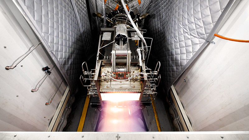
Hermeus, a startup building a hypersonic aircraft capable of traveling five times the speed of sound, has completed a major milestone in engine testing. The company successfully demonstrated that its engine can transition from turbojet—like what’s used in passenger aircraft—to ramjet, a much more powerful engine technology.
Hermeus 101: The Atlanta-based startup is moving fast in every sense of the word. The founders came onto the scene in 2019 with plans for a hypersonic aircraft, won a $1.5M USAF contract a year later, and since then, have been heads-down building their technology.
Earlier this year, the company raised a $100M Series B to complete the development of this aircraft, which has its first flights slated for 2023.
Keep reading