
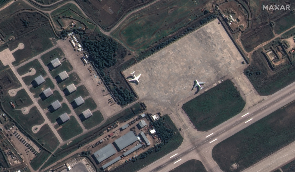
Maxar unveiled a new product today to provide persistent monitoring of sites around the world, making it easier to spot anomalies or recognize patterns.
The new system—dubbed Sentry—will allow customers to task Maxar’s existing hardware on-orbit in a new way, according to Chief Product Officer Peter Wilczynski. The system includes Site Sentry, which allows for monitoring of small areas like ports, airports, and city centers, as well as Maritime Sentry, which looks at a broad swath of ocean to track ships at sea. Sentry relies on automation for everything from tasking satellites, to detecting changes over time.
Use cases: Sentry can be useful for any customer that wants to simultaneously monitor multiple places related to each other, Wilczynski said. He laid out an example where the system spotted ships coming into port, and watched vehicles trying to cross a border, during an effort to track fentanyl. He also gave the example of watching a warehouse nearby a launch site, and being able to determine that a space launch followed a certain number of days after increased warehouse traffic.
“A really common use case is with a supply chain that has a bunch of precursors, storage places, and production facilities,” Wilczynski said. “It’s how to use stuff from one facility to infer what’s happening at another.”
Taking pictures at regular intervals of specific sites also ensures customers have a backlog of imagery to view if an anomaly does pop up. In other words: “How do we make sure we have the right ‘before’ pictures, as opposed to just taking pictures after an event happens?” Wilczynski said.
Sentry’s heritage: Some of the tech used in Sentry has already been tested for defense and intelligence customers, including for NGA’s Luno program. Under that program, Maxar used automated tools to quickly identify objects, like cars or aircraft, within hours of a spacecraft snapping the image.

NRO Awards Contracts to Three Remote Sensing Companies
The contracts, announced on Tuesday, are intended to allow the intel agency to access multiple remote sensing phenomenologies from EO to RF and beyond.

Airbus Taps Skynopy for Pléiades Neo Ground Stations
The European space market may be dominated by large A&D primes, but the startup community is proving it still has an edge when it comes to innovative tech.
HEO Buys Satellogic’s In-Orbit Sat
Why build a new satellite, when you can buy one already in orbit?

Loft Orbital Wins €50M Contract to Build French SAR Sat
The demo is part of France’s DESIR program, which is intended to widen the pool of EO capabilities available to the French defense sector.

NATO allies have agreed to boost defense spending. While space isn’t among the listed priorities for the extra funding, experts predict nations will beef up their national security capabilities in orbit.
Context: The 2025 NATO Summit began today in The Hague, Netherlands. At a press conference Monday ahead of the gathering of global leaders, NATO Secretary General Mark Rutte said new spending will go towards increased air defense, more tanks, building up munitions stores, and supporting the defense industrial base—all gaps that have been exposed by Russia’s invasion of Ukraine.
“We meet at a truly historic moment, with significant and growing challenges to our security,” Rutte said. “As the world becomes more dangerous, allied leaders will take bold decisions to strengthen our collective defense—making NATO a stronger, fairer and more lethal alliance.”
Keep reading