

The commercial remote sensing industry is on the rise but needs more backing from the government to reach its full potential, according to a report released Wednesday.
The 45-page report from Georgetown University’s Center for Security and Emerging Technology was written by Maj. Michael O’Connor, a Space Force fellow at the center, and research analyst Kathleen Curlee.
Exponential: It’s not just your imagination—commercial remote sensing is taking off. New companies in the sector were founded ten times faster in 2015 than they were a decade earlier, and though growth has slowed from that peak, it remains high due to four reasons, according to the report.
- Tech development, including the shrinking size of sensors
- The decreasing costs of getting into orbit
- New ways to fund business ideas, including VC backing
- Stable regulations
Overcoming challenges: Despite its impressive growth, the industry is facing a series of challenges, according to the report.
- Too little exploration of benefits offered by infrared, hyperspectral, and VLEO imaging capabilities
- The debris created by the large constellations required for imaging
- The threat of adversaries targeting commercial imaging sats
Recommendations: The paper highlights a few recommendations to address some of these problems:
- Boost government purchases from both commercial remote sensing companies and space data analysis companies
- Review regulations to see whether limited “location-specific controls” could better protect allies or US troops in times of conflict
- Continue federal investments to develop cutting edge sensing technology
ICEYE Smashes Its Own Revenue Projections
ICEYE’s results reveal a massively successful year for a business in the right place at the right time.
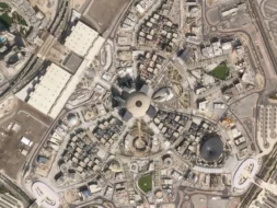
Planet Labs Extends Middle East Space Imagery Restrictions
Planet Labs just proved that dual use doesn’t necessarily mean equal priority.
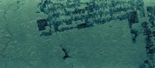
ICEYE Launches New Deforestation Monitoring Tool
ICEYE just one-upped the Lorax. Instead of speaking for the trees, the SAR satellite manufacturer is letting the trees speak for themselves.
Remondo Unveils Plans for Sub-30 cm Resolution Sat
The company believes it can eventually build, operate, and launch each sat for $2M or less, according to CEO Ido Priel.
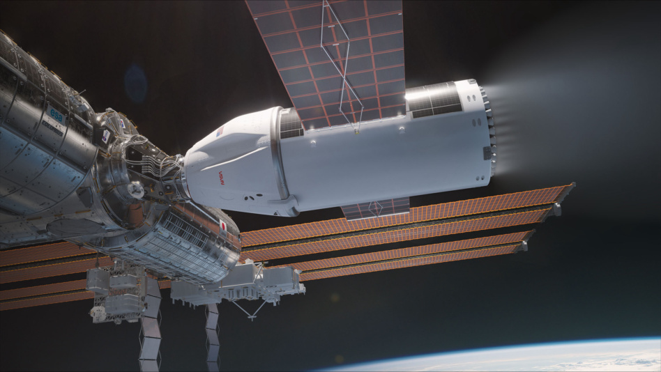
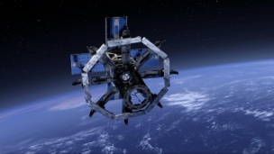
NASA put out an $834M hit on the ISS, and SpaceX won the contract. Yesterday, NASA and SpaceX shared new information on how the job will go down.
After over 25 years orbiting Earth, performing thousands of scientific experiments and hosting over 270 astronauts, the ISS is scheduled to be escorted out of orbit as early as 2030.
A bigger Dragon: SpaceX’s deorbit vehicle will be based on its Dragon spacecraft, which has flown 40+ missions to the ISS, but the deorbit mission requires that SpaceX redesign about half of the spacecraft to significantly boost how much propellant it can carry and power it can generate.. To accomplish this, the deorbit vehicle will have an extended trunk to fit the extras required to operate onboard the ISS for its final 18 months.
Keep reading