Canadian space data company Wyvern has launched its Open Data Program to provide free high-resolution hyperspectral satellite imagery to the EO community.
The program will allow free, unrestricted use of images captured by Wyvern’s three Dragonette hyperspectral satellites under the flexible public release creative commons license as long as credit is attributed to Wyvern.
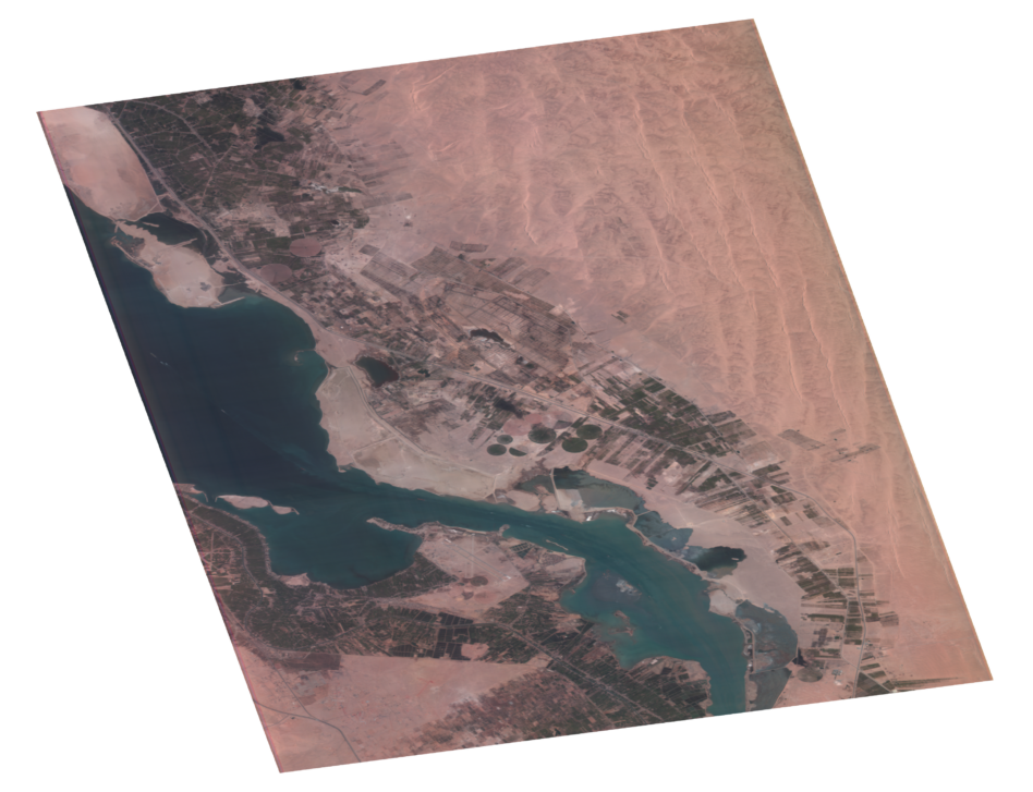
The EO revolution: The first release of the program includes 25 images of land features ranging from forests to wildfires to crop fields to solar farms. People can download them from the Open Data Program site, simplifying and speeding up the process to access critical data.
Wyvern plans to launch its fourth and fifth Dragonette sats this year, with the fourth lifting off as soon as next month.
“Wyvern will be consistently releasing additional datasets to our Open Data Program on a regular basis with the tempo increasing as our constellation grows over the course of 2025,” Adam O’Connor, Wyvern’s chief product officer, told Payload. “We expect to release new data to the Open Data Program on a monthly basis.”
Data for all: Wyvern’s Open Data program was inspired by similar programs from other companies, such as Umbra’s Open Data Program for SAR. Wyvern specifically selected a creative commons license for the program that would allow sharing and eliminate any severe licensing restrictions.
“Making data freely available for researchers and developers to experiment with has been a goal at Wyvern from the start,” cofounder Callie Lissinna said in a press release. “We created Wyvern to make Earth better from space, and we’re proud of how this Open Data Program contributes to that.”