
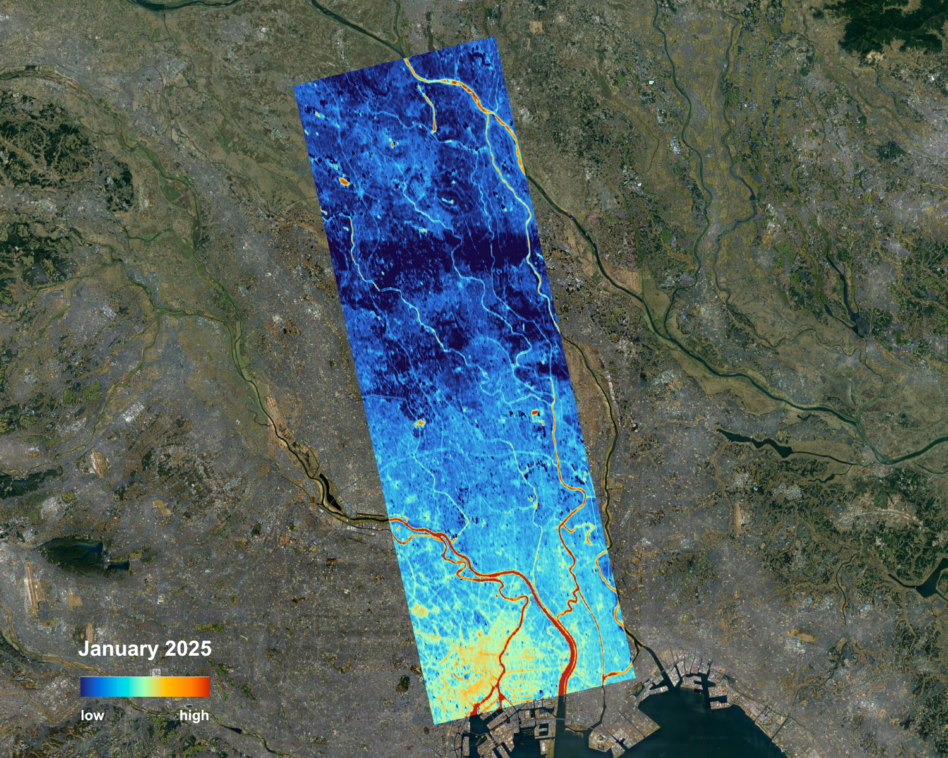
constellr, a German thermal EO startup, shared the first heat-map image taken by the company’s debut satellite—SkyBee-1.
As part of the company’s planned HiVE (High-precision Versatile Ecosphere) thermal imaging constellation, SkyBee-1 aims to vastly improve the thermal imaging data being collected on orbit by offering greater spatial and temporal resolution than others in the market.
“It’s more or less a step change because yes, Landsat and various different instruments do exist that measure temperature to date, but the granularity of that data is not as good as our satellite,” Cassi Welling, managing director and COO of constellr, told Payload. “The more satellites we launch…we should then be able to get this daily and global revisit. So, there’s the granularity in terms of the time resolution, temporal resolution, and space resolution.”
Temp check: As the climate gets warmer, and weather events grow more volatile, constellr hopes its thermal data will help governments and businesses use resources more efficiently. By measuring ground temperatures from space down to 30 m in resolution, constellr can help its customers make climate-informed decisions that make a real economic impact.
“We want to have a climate focused angle. We want to support cities [to] become more climate resilient, but we also appreciate that in the face of some of these geopolitical changes that there are other stories that also need to be shared,” Welling said. “Some of these really important national security topics that link to water security [and] food security will very much be in the domain of EO monitoring, particularly thermal data.”
What’s next: constellr plans to add to its HiVE constellation methodically, launching the company’s second satellite in June, one or two more each year after, and larger batches down the line, according to Welling.
In total, the constellation could have as many as 30 satellites in the coming years, and future sats are expected to have increased resolution capabilities down to 10 m.
These improvements will allow for greater revisits to map changes in ground temperatures more regularly. And more precise data will allow city and agricultural planners to be more targeted in their decisions—whether analyzing the climate efficiency of a specific building, or the health of a given plot of land.
This story has been updated to correct Cassi Welling’s title, which is managing director and COO.
European Space Startups Jockey for ‘Infrastructure’ Financing
Europe has a growth-stage-capital problem.

Meet Blacknight Space Labs In-Orbit Infrastructure Accelerator
Blacknight Space Labs will provide companies up to $100,000 each. In addition, accelerator companies will get startup 101 education, mentorship, assistance breaking into the defense space market—and help with everything from fundraising, to navigating the government contracting system, to finding customers.
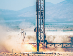

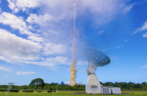
Fenix Space Flies Tow-Launch Prototype
Fenix Space is one step closer to leaving the world behind.
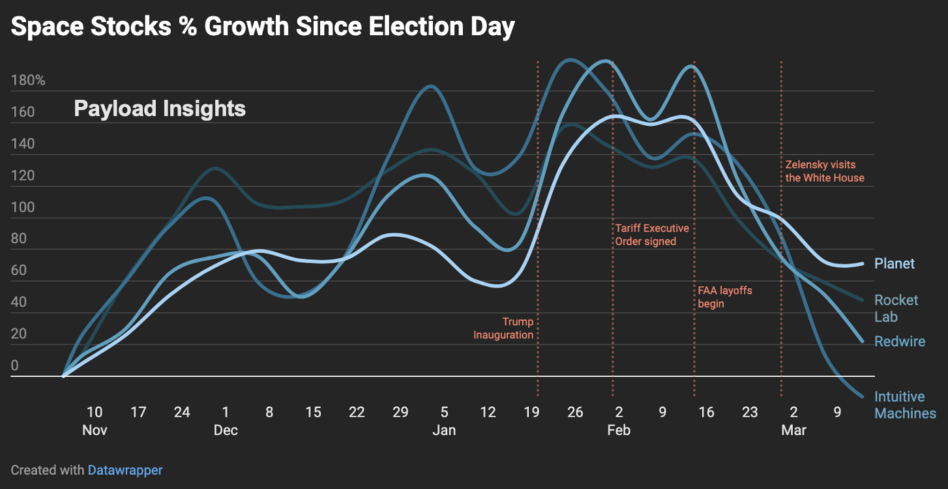
President Donald Trump’s first term was a boon for the space industry. His first administration reestablished the National Space Council, created closer ties between the commercial sector and civil decision makers, attempted to streamline launch and reentry licensing requirements, and stood up the Space Force. So, it’s no wonder investors were bullish on a second term.
Space stocks soared in the wake of Trump’s election win. By Inauguration Day, four of the largest space stocks by market cap had doubled in value on the expectation that Trump would continue the progress made in his first term.
Enter reality: During his inauguration speech, Trump highlighted his determination to put US boots on Mars, and “pursue our manifest destiny into the stars.” Space stocks flew even higher.
Keep reading