
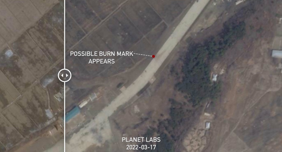
A screenshot of NK Pro’s before-and-after analysis of Feb. 12 and March 17 Planet satellite imagery overhead a site near Pyongyang. Image via NK Pro.
North Korea claimed to launch Hwasong-17 on Thursday. Analysts have described the ICBM in question as a “monster missile.”
In Pyongyang’s telling…
…the mega-ICBM, first unveiled at a military parade in Oct. 2020, was test-fired Thursday.
The missile reached an apogee of ~6,200km, per the South Korean military, which would represent a new record for the hermit kingdom’s ballistic missile program. In other firsts, the monster missile is believed to be the world’s largest road-mobile liquid propellant ICBM.
- Side note: Kim Jong-Un starred in an absolutely bizarre Hollywood-esque hype video for the monster missile. State-run media mouthpieces broadcast the propaganda, which also made the rounds on Western news networks and social media platforms.
Why hedge with the language?
Some experts and Pyongyang watchers are disputing that the launch was successful. Colin Zwirko, a senior analyst at NK News, wrote Friday that “multiple pieces of visual evidence suggest North Korea’s version of events is misleading at best, and possibly a complete fabrication of a successful Hwasong-17 test at worst.”
A missile launched Thursday traveled ~1,080km over the course of 71 minutes, from a launchpad near Pyongyang into the Sea of Japan, per the FT. But senior government officials in Seoul believe the missile may have in fact been the smaller Hwasong-15, South Korea’s Yonhap News Agency reported.
- The Hwasong-17 may have been misfired nearly two weeks ago. In mid-March, a missile exploded at an altitude of ~20km after launching from somewhere near North Korea’s capital.
The space angle
South Korea and allies’ assessment was shaped by classified intelligence capabilities, including a thermal sensor-equipped satellite, per Yonhap. And Zwirko’s analysis, which you should read in full, draws extensively on Planet imagery to show how Pyongyang’s version of the story might not pass muster.
The bigger picture: Without the resources of nation-states or their spy agencies, private actors can track troop movements, ICBM staging, and other geopolitical developments using public data.
We’re in the golden age of OSINT via satellite. As we wrote on the eve of Russia’s invasion of Ukraine…“What was once private can now be shared for the world to see in plain sight.”
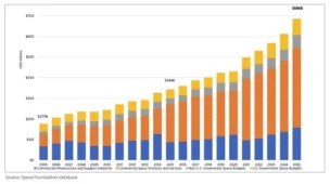
Breaking Down the $686B Space Economy
The global space economy totaled a record $686B in 2025, according to the Space Foundation.
DoD Adds $11.4B to NatSec Launch Contracts
The DoD upped its ceiling for national security space launches on Friday, more than tripling the pool of NSSL launch contracts from $5.6B to $17B.

NatSec Space Policy Nominees Face Questions from Senators
The Pentagon’s nominee to lead space acquisition said the military’s legacy space programs weren’t built for the modern acquisition reforms now reshaping the Space Force.

Pulse Space Lands $40M Space Force Contract to Develop Laser Tech
Pulse Space, a WA-based startup building laser systems capable of beaming power to other satellites on orbit, announced a $40M Space Force contract.
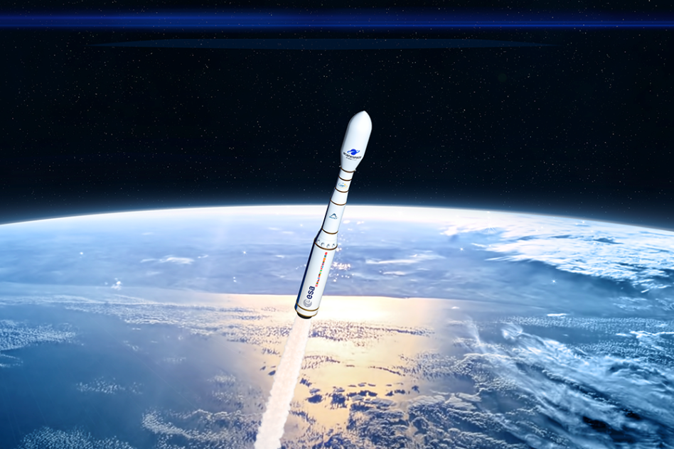
Arianespace’s Vega C rocket’s upper stage uses engines built by Ukrainian space contractor Yuzhmash, Stéphane Israël, Arianespace CEO, said on a panel at Satellite last week. The company has three engines in storage, ESA officials said March 17. That’s not much of a strategic stockpile, especially as doubts linger that the Europeans will be able to procure more.
Losing access to Soyuz has thrown a monkey wrench into Arianespace’s 2022 plans. Several launches that were set to ride with Soyuz must now find new tickets to space.
A vote of confidence? Avio is Vega’s primary subcontractor. On Friday, the Italian space company said “no specific impacts on Vega and Vega C continuity of operations are foreseen in the medium term.” Procurement of Ukrainian-made parts for Vega and Vega C began “several years ago” and will cover launches expected through 2026, Avio said.
Keep reading