
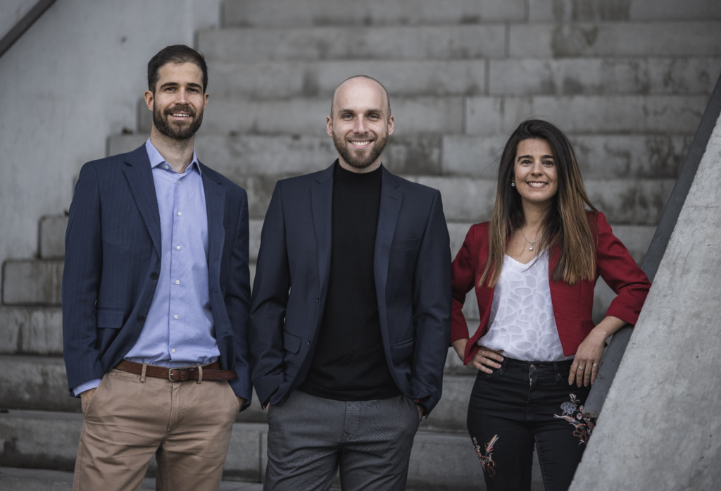
Last week, Vyoma won the Startup Space pitch competition at Satellite 2022. Dr. Luisa Buinhas, a cofounder of Vyoma and space systems engineer, delivered the winning pitch. Payload wasn’t able to catch up with her on-site, but we did speak with Dr. Stefan Frey, an astrodynamics specialist and fellow Vyoma cofounder.
Incubated within the ESA, the European startup is developing an orbital warning system that will run on space telescopes and an accompanying suite of software. Find the full conversation below. (NB: This interview was edited for clarity and length.)
Vyoma pitches itself as an “operating system for space.” What does that mean in practice?
We’re protecting space assets from collisions with other satellites or debris. Importantly, we also want to lower the threshold of what can be seen down to 1 cm. Right now, 5–10 cm objects are being tracked. Debris have a logarithmic distribution, in terms of size. There are ~35,000 objects down to 10 cm. But there are up to 1M objects already up there that are 1 cm and/or bigger. They are still a threat to satellite operators because they carry a lot of energy. Just a small aluminum cube can carry the energy of a hand grenade.
Even specks of paint are a threat, right? How does that track with what you’re doing?
Yeah. So we want to launch telescopes into space, to do space-based space surveillance. Since we’re in situ, we can actually see all those small objects and see them often enough to build a catalog, maintain that, and warn satellite operators. Not only that, we also want to provide automated optimized planning of maneuvers…all the way to full automation of satellite operations. Automation is our vision.
We want to protect the space environment from further collisions because we understand that if there are maybe 5 to 10 more collisions, we probably won’t be able to use space as we’ve been using it today.
That’s quite the wake up call. Where to go from there…What does the near-term future hold for you?
We have a two-pronged approach. One side is our own satellites, where we’re procuring the parts for the payload, a telescope. That will be tested end-to-end—telescope plus sensor plus processing chain—in the simulator. We’ll test that by the end of the year, and launch the first two pilot satellites in Oct. 2023.
We’ll use these as proofs of concept but also to generate data and do on-demand tracking from space. The second prong is partnering with ground-based telescopes. We have a network of 15 globally distributed telescopes and can already provide services using exclusive data from those telescopes.
What would you say is the gold standard of tracking right now? Is it the Space Force unit in Colorado?
Yeah, absolutely.
But they only go down to a certain threshold.
Yes. And they provide data to everyone. What’s important to note is that they don’t provide the raw data, because they don’t want anyone to understand how good their radars are. It’s already processed information—projected into the future—or TLEs [two-line elements]. It’s not so easy to reverse engineer that.
Surveying the landscape, LeoLabs is doing ground-based radars. Why would the other ground-based radar players partner with you rather than build it themselves?
You can only see so far with radar: usually, LEO objects. If you go to telescopes, they can see the MEO and GEO regimes. They’re now getting faster and are able to turn, so they can start seeing the LEO objects. The problem with LEO objects and optical telescopes is that if the object is in the Earth’s shadow or if it’s during the day, you actually don’t see them. For LEO, usually radar is better. With telescopes, you can see farther away, so you can choose a stationary ring.
We basically combine this, taking the best of both worlds by going into space. We will be able to monitor 24/7 using telescopes. 24/7 LEO, MEO, and GEO.
What are the key components and technologies and everything that are going into the eventual telescopes on-orbit?
We need to reduce this to a point where we can then download it. To do that, you need a big aperture and on-orbit processing. We’re taking 5 pictures a second. We’re going to have 12 satellites. That’s huge amounts of data we’re collecting…up to 50 objects simultaneously.
The hardest part is data association. Let’s say you have a T1 from yesterday, an image here, and then today, you have an image there. And you see a couple streaks. How do they belong together and how do you know it’s the same object? What we need to do is data association to then do orbital information.
If you only have the image, you only have angular and not yet orbital information. Once you do the data association, you can really get the orbits. That’s what you need to build the catalog. That’s our core IP and it’s the hardest part.
What’s your background? And did past experience inform you and your cofounders’ decision to start Vyoma?
I was working at the European Space Agency.
Oh, right: you’re a spin-out?
I’m not sure spin-out is correct, to be honest. We all had projects with ESA and I worked there. But it’s not like ESA told us: “Spin-out now into this new thing.” We went out, said “we want to do this,” and were then incubated by ESA.
Incubated. There you go.
I was working at the space debris office, specifically looking at how different actors around the world were adhering to space debris mitigation guidelines. Were they reentering their objects after end-of-mission? Were they doing collision avoidance maneuvers?
I then decided to do a PhD in orbital fragmentation modeling. What that means: If you have a collision or explosion in space, how do thousands of new fragments distribute around the world and how do they affect other satellite operators, in terms of collision risk?
Christoph, one of our cofounders, does laser-ranging orbit determination. It’s yet another way of connecting data. You shoot up a small light pulse and get the result. He was using this information to do orbit determination.
The other cofounder, Luisa, did her PhD in astrodynamics and focused on satellite formation flying. She’s in charge of our space segment.
What are the key algorithms for on-orbit processing? I actually don’t know. Sensor fusion, computer vision…what does that look like?
What we do onboard a satellite is very much computer vision. And because it’s 2D images, it’s actually not that hard. You have to see the streaks and stars. What’s difficult is achieving subpixel accuracy. Because the object is so far away, it’s much smaller than the pixel itself. It will streak over a couple of pixels because of the orbital relative motion. With this, we can actually achieve subpixel accuracy because we really take out where the object is in the picture itself.
An AI question: There’s not a huge amount of training data for this, right? How do you square the circle?
We’re building our own catalog of synthetic images. We’re simulating all this, meaning we have the ground truth. But there’s issues when you go from synthetic data to real data. Luckily, we already have the ground-based sensors and real data. It’s not space-based data, though.
How does what you’re building stack up against Privateer, one of the buzziest space startups to emerge of late?
We actually talked to them yesterday [3/23/22]. I think they’re coming from a similar angle of protecting the environment and that what they want to do is build a marketplace where everyone can compete and contribute to.
In the end, of course they are competition. But in a certain sense they’re also partners. They’re using quite different technology with cheaper CubeSat satellites that only look around their immediate vicinity. They’re actually going to have to use hundreds of small satellites just to cover a small altitude range.
We go out there with just a few satellites and we look at all the other ranges. It’s quite a different technology. I think they stack more sensors in there, and that the data we generate is actually even more complementary and not the same.
Are space debris an issue that has been neglected? If so, why?
Three issues. #1 is that we’ve been treating space as an infinite resource. We realized there is a capacity that can be reached, which could then bring you to the problem of the Kessler Effect.
#2: We have mitigation guidelines, but they’re only guidelines. The discussion has been stuck at the UN level for decades. Some countries don’t want to hold back development. They say to Russia and the US: “You have already polluted [space] so much. Now, it’s our turn to launch whatever we want.”
There’s a perfect parallel with CO2 emissions. Developed countries have historically been responsible for cumulative pollution. But when they want to decarbonize and tell developing countries to follow suit, it doesn’t exactly seem fair to the latter. But to get back on track, what’s issue #3?
Remediation, or active debris removal, is too expensive. And who pays for it?
Governments have a vested interest in this, but there would seemingly also be a market on the commercial side. If you play this scenario out, and there are the Keppler-esque cascading chains of events and orbits become unusable, that impedes all space activity.
You can actually see that already in the geostationary orbit. GEO operators behave quite well because they know that if they pollute their own segment, they won’t be able to launch there anymore. As soon as it really hits their own interests, they start to behave the way they should.
It’s clear the debris problem is particularly acute in key orbits. Based on your experience and what you’re building now, what are the orbits that worry you most?
Everything above 500 to let’s say 700 km. 500–600 is a very interesting region for Earth observation. The objects remain there for a couple of years to maybe decades. From 700–800, you enter the regime where objects are going to stick around for 200 or 300 km. If we mess that up, generations will go by before we can use the regime again.
There’s a trend right now of going to even lower orbits, and operators use active propulsion to stay in the same orbit. Because the atmospheric density there is so high, it actually washes out quite fast. The good news there is that despite however much they pollute, the object will come down in a couple years.
I’m trying to formulate a new metric on the fly right now. But where do we have the least amount of visibility vs. the max amount of damage that could be inflicted on a spacecraft? If that makes sense…
There is this kind of valley of death.
We can shield against objects smaller than 1 cm. There are objects 10 cm and larger that you can see and dodge. In between, you don’t know where the 1–10 cm objects are. They can still end your mission and they are very numerous. There’s an order of magnitude more objects than the 10+ cm objects. This is the blind spot that we have to cover, and that’s why we’re launching our own test satellite.
Who are your future customers?
The EUSST is an entity that wants to collect all this data. They would be a buyer of data, so that’s helpful. However, we have to be careful in how we set things up. We don’t want someone to buy our data and then give it to everyone for free.
A scenario in which your data becomes non-proprietary and you become a quasi-public entity.
We could set it up like US-based companies, where we provide already-processed data and customers get all the warnings.
What are the key space verticals you intend to serve?
There’s interest from the defense side, simply to protect their own assets not from debris, but hostile actions. A big market on that side.
The other big market we’re targeting is the satellite operators themselves. They also want to protect their assets. And that goes hand-in-hand with insurance companies. We know that if satellite operators are using our service, they’ll have to pay lower premiums. So we can work with the insurance sector.
Finally, a smaller market is the space agencies themselves who want to know what’s going on up there. Even at ESA right now, there’s a push toward capacity. If you launch something that would endanger the environment, you won’t be allowed to launch it. Or if the risk of collision is too high in a full orbital regime, you’re not going to be allowed to launch there.
What are your thoughts on licensing at an international level? Do you think it could be a race to a bottom?
Could be. At the ITU, with communications, they’ve worked this out. It is possible [that big space players could unilaterally reduce how many communications licenses they file], but nobody wants to be the first-mover and block their own space industry.
I think we’ve covered the orbits and use cases where short-termism is most prevalent. What are the best practices, for lack of a better buzzword, that these players could implement to reduce collision risk?
Tough question.
If you have a car, it has certain standards. You need a seatbelt and airbags. I think we could do something similar with satellites. If you don’t have maneuver capabilities, for example, it might be a no-go in the future, because you can’t move out of the way of incoming debris.
I think it will have to go through standards, but the standards will have to be enforced, right?
Yeah, and that’d have to go through some licensing body?
Yes.
Are there any other space-to-space considerations you would suggest operators build into their stack?
A module for someone at a later date to easily attach to you. And retro reflectors, which you can use to identify an object with laser. I think both would be very helpful.
That’s interesting. But you have to square that with the trend towards miniaturization and cost curves coming down.
It’s getting so cheap and so fast to launch that people just say: “I don’t care if my satellite blows up because six months from now, I’m going to have another satellite in space.” This is a very dangerous path, in my opinion. It’s true you can launch again, but the risk is so much higher, especially if you’re going into the same orbit altitude. You basically polluted your own orbit, and you’re just make it worse.
I get the impression that your satellites are going to be more expensive than competitors, alternatives, or satellites with similar functions.
We want to be reliable and we also want to be good stewards ourselves. If you throw hundreds of CubeSats up there, you’re not exactly making the problem better. You’re actually making it worse. These CubeSats just have a very bad track record.
I know Privateer wants to deorbit satellites and I hope they will achieve it. If you have a failure rate of 5%, you can easily calculate how many objects you’re actually adding to the environment. This is what we want to avoid, of course.
Anything else you’d like to add?
I think what is important is that we have to come together on space traffic management. It’s an inherently global challenge. What we need to do is raise awareness, go to our politicians, and push them to start cooperating internationally. There is a lot of gridlock right now.
In the last month with our current geopolitical situation, I don’t really see how this is going to work out in the near-future.
It feels like current events have been a coming-of-age moment for the space industry.
But they also show how vulnerable everything is.
Optera Raises £3M to Open New UK HQ
The funding round comes amid the UK government’s full-court press to expand its sovereign technical capabilities.
Commerce Aiming to Open Novel Space Applications This Summer
In March, the Office of Space Commerce (OSC) unveiled its plan to serve as a one-stop shop for licensing novel space missions.

NASA Administrator Jared Isaacman On Artemis, Budget, And Establishing a Lasting Space Vision
“There’s a lot of passionate people out here. They can do incredible things from a scientific perspective,” Isaacman told Payload. “I don’t know how many of them have ever pulled together a financial model, and driven execution on some of these things, to say what should or shouldn’t be the right budget.”
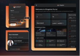
Slingshot Introduces AI-Powered Portal Platform
Slingshot Aerospace introduced a new platform today that will allow operators to spot anomalies—and make decisions—in an AI-powered, one-stop-shop.

In a victory for NGOs and activists who have been pushing for more environmental accountability in space, the UN has adopted a provision that will ban the use of mercury as a satellite propellant.
The UN provision: On Saturday, the UN added satellite propulsion to a long list of banned use cases for mercury under the Minamata Convention on Mercury, of which the US was the first signatory. 137 countries around the world have committed to the Minamata Convention, and the responsibility falls on those individual governments to enforce the ban.
Flash back: In 2018, the NGO Public Employees for Environmental Protection (PEER) received a whistleblower complaint that a Silicon Valley startup was building satellite propulsion systems powered by mercury. The whistleblower worried these systems would discharge mercury into the upper atmosphere, which would then make its way back down to Earth.
Keep reading