Satellite Imagery Helps Pierce through Fog of War in Ukraine
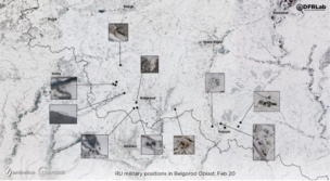
Last Wednesday, in the lead-up to Russia’s full-scale invasion of Ukraine, we wrote about how commercial satellite imagery laid bare the open secret of Moscow’s military mobilization. Satellite imagery has contributed to a growing corpus of open-source intelligence (OSINT) analysis, a vital asset helping to pierce through the fog of war. Newsrooms, analysts, and amateur […]
