



EO data is a privilege, not a right, and the US government wants to control what EO satellite operators can and can’t share with the public.
Under a proposed bill—the 2027 Intelligence Authorization Act (IAA), which passed the House Permanent Select Committee on Intelligence this week—the US government would implement measures to block EO operators from sharing “sensitive imagery that could harm national security” with the public, according to a summary posted by the House Intel Committee.
All for one: In recent years, geospatial intelligence gathered by commercial EO operators has proved vital in US and allied efforts to maintain an edge in conflict zones. The value of EO data over Ukraine—to spot troop movements and to assess damage from bombing campaigns—sparked a surge in geospatial-intelligence demand from national governments.
Meanwhile, geospatial data has also helped media outlets and social media users shed light on the progress of conflicts in Ukraine and Iran, generally making it easier to cover conflicts from a distance.
But the door is quickly closing on that carte blanche commercial access.
In March, Planet Labs extended a hold on commercial access to EO imagery over Iran and neighboring Gulf states after consulting with “experts inside and outside of the government,” according to a Planet spokesperson. Planet added that its decision wasn’t the result of a government request or pressuring, but one made internally to protect US national interests.
The IAA proposal would effectively end EO operators’ ability to self-regulate, codifying the government’s control over what the public can and can’t see.
The bottom line: While the proposal stands to potentially limit the commercial revenue streams of EO satellite operators, it’s not all bad for business. IAA also contains provisions to boost the intelligence community’s use of EO data across government departments, including:
- Language to encourage the US government to direct commercial remote sensing requirements to better meet the needs of American intelligence agencies;
- Measures to improve the intelligence community’s dissemination of open-source intel;
- And a direction to evaluate opportunities for further enterprise services in the realm of geospatial intelligence.
While the bulk of US-based EO operators did not respond to Payload’s request for comment (a spokesperson from Vantor said the company is reviewing the bill), a spokesperson from ICEYE shared the company’s hope that the bill could ultimately deepen ties between the EO community and the DoD.
“Given the complexity and diversity of these systems, getting it right will require [the director of national intelligence] to give commercial operators a seat at the table—building an oversight process that protects operational security while preserving the industry’s ability to serve as a cornerstone of the US space economy,” the ICEYE spokesperson told Payload via email.
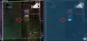
InnerPlant’s Glowing Soy Demos Hyperspectral Use Case
InnerPlant, which was founded in 2018, has enabled plants to let humans know when they’re under stress.

DIU and SSC Announce Joint GHOST-R Mission
DIU and SSC announced GHOST-R, a joint effort to bring low-cost reconnaissance to GEO under SSC’s RG-XX program.

States Campaign to Host the US Space Academy
Ever since President Donald Trump signed an executive order on Aug. 28 establishing a US Space Academy, states have been coming out of the woodwork to make the case for why the school should call it home.

Hydrosat Unveils Osiris Constellation Ahead of 2027 Launch
Very rarely can someone offer you the best of both worlds, but Hydrosat’s newest constellation claims to do just that.

As the UK touted its aerospace achievements at the Farnborough Air Show, new Prime Minister Andy Burnham saw the perfect opportunity to scrap the department responsible.
Burnham, who took office Monday, announced yesterday that the Department for Science, Innovation, and Technology (DSIT)—which housed the UK Space Agency (UKSA) after a shakeup last year—is no longer.
DSIT will be replaced by the Department for Business, Innovation, Science and Trade; the Department for Digital, Culture, Media and Sport; and the Cabinet Office. Officials from UKSA declined to comment on the reorganization.
Keep reading